After our little brief warm up, people are now
asking what happen to spring again....2013 has been a year without a
spring....This weekend will feel more like a fall weekend than a spring
weekend.... Normal highs...Today...66 Forecasted high of 60....-6 degree below
normal....Saturday normal high is 66. Forecasted high of 48...-18 below
normal...Sunday normal high is 66 forecasted high of 50...-16 below
normal....Lows will be cold also...38 tonight 27 Saturday night 33 Sunday
night......No spring in the Northwoods.....Monday still looks to be cold with
below normal temps....Good news is there is another warm up on its way....More
on that in a few......
***CURRENT CONDITIONS***
All stations reporting sunny skies, temps in the
lower 50s....Winds from the North/Northeast from 5 to 6 MPH..EAU reporting wind
gust up to 17 MPH....
Dewpoints across the area are in the lower to
middle 20s.
***FORECAST DISCUSSION***
Look for late October/early November temps for this
weekend.....For today High pressure North of Lake Superior will keep a dry cold
flow over the area....This will keep skies sunny throughout the day.....Winds
should begin to slacking off as we head through the afternoon....Meanwhile we
will see a weak cold front move into the area later tonight, this will bring
another reinforcing shot of cold air....Moisture is limited with this cold
front, however we still be see a good chance of showers later tonight....Front
sweeps through the area rather fast...So look for clearing skies to start your
Saturday....Winds tomorrow will be brisk from the Northwest 10 to 20 MPH with
gust up to 25 MPH...Saturday night the winds die off and under clear skies look
out we could be looking a a hard freeze event, frost will be likely at the
least......Sunday will shine with sunny skies, but temps will still be cold!
Sunday night should see another round of frost...Monday we will see a warm front
slowly starting to work its way towards the area......This should spark off some
showers and thunderstorms.....Temps will still be running below
normal.....Tuesday is going to be a pain in the butt with temps.....Warm front
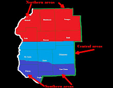
is forecasted to push into my Western areas....Now if this warm front clears the
whole forecast area this would be easy...Some computer models not seeing eye to
eye on far the front will make it on Tuesday....West of the warm front temps
soar into the middle to upper 80s, while East of the front temps reach for the
lower 80s....Warn front will have cleared the whole area Tuesday night, only to
be followed by a cold front Tuesday night.....This will knock the temps back
into the 70s for the rest of the week......Also there will be a chance of
showers and thunderstorms for the rest of the week....Severe thunderstorms seen
unlikely at this time......
To sum it up....
This weekend will be cold, followed by a warm up,
then followed by a slight cool down....Showers tonight....Then dry the rest of
the weekend.....Then off and on chances of showers and
thunderstorms......