Monday, January 30, 2012

Fast forecast discussion.

Weather headaches yeah there are a few mainly for late this weekend into early next week…..


A cold front will pass through the FA tomorrow, moisture is null in my Central and Southern areas…Northern areas will be closer to better forcing so would not be shocked to see some light drizzle or flurries. Temps will still be warm tomorrow lower to middle 30s in snow packed areas, while some upper 30s to lower 40s across the little to no snow pack areas.

Rest of the week looks dry and temps will slowly cool off into the weekend.

Problems show up big time on the model in regret to snow or sunny skies… GFS and GEM has been trending North with a low pressure system…..This system is forecasted to move into Southeast MN Northwest of Rochester then its Forecasted to Move Towards Eau Claire before heading almost do East….This would put Southwestern MN through Central and Northeast MN as well as my Central and Northern FA in the prime area for snow, While my Southern zones would see all rain from this system……Now ECWMF model has this same low way down in the Ohio Valley. If this plays out the upper mid Midwest would remain dry…..As always EC model has been and will once again be the model of choice for now…We will work out all the details on Wednesday and will issue a forecast ATTM….As this forecast discussion has covered the forecast well.

Rest of the week into the weekend…Dry with highs slowly cooling down to the upper 20s to lower 30s by the weekend. Lows will be cooling off from the middle 20s to upper teens to lower 20s by the weekend…Computer models are in agreement of colder air coming into the FA next week….

Sorry time does not allow for me to go into more details into the forecast… I do agree with my Southern/Southwesterly neighbor WEATHER 4 YOU so will point my veiwers that way to Wednesday.....Link can be found to the right.

Friday, January 27, 2012

Snow/this morning AU

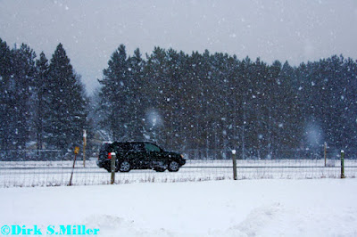
Here is a picture of a heavy snow band that moved into the area.Followed by the Northern Lights pictures.(just a few)


Wednesday, January 25, 2012

More snow last night

More snow fell across the FA last night into the early morning hours....Once again my Southern areas got ripped off they only picke up from 1/2 of snow to as much as 1.50 inches....While my Northern areas picked up 2 to 3.50 inches of snow....Here at the office we picked up 3.25 inches of snow....

Monday, January 23, 2012

Snowfall amounts as of 6:00PM

Here at the office we picked up 4.50 inches of snow…Below is some reports from our own weather observers …


Haugan. 4.50 inches of snow.

Brill 5.00 inches of snow.

Bruce 4.50 Inches of snow.

Rice Lake 3.5o inches of snow…

With our reports and the NWS reports below, one can see the highest amounts of snow have falling across my Central and Northern areas…..Notice the more West you get to MN the snow totals drop off big time…..
Here a list of the storm totals…This info below comes from the NWS.

0957 AM SNOW CUMBERLAND

01/23/2012 M3.0 INCH BARRON WI TRAINED SPOTTER

0259 PM SNOW CLAYTON

01/23/2012 M2.0 INCH POLK WI TRAINED SPOTTER


0340 PM SNOW MENOMONIE

01/23/2012 M2.3 INCH DUNN WI TRAINED SPOTTER

0543 PM SNOW IRON RIVER

01/23/2012 M5.0 INCH BAYFIELD WI BROADCAST MEDIA

0220 PM SNOW SPOONER

01/23/2012 M4.0 INCH WASHBURN WI CO-OP OBSERVER

0400 PM SNOW HERTEL

01/23/2012 E5.0 INCH BURNETT WI TRAINED SPOTTER

0408 PM SNOW 2 W HAYWARD

01/23/2012 E5.0 INCH SAWYER WI TRAINED SPOTTER

0446 PM SNOW MAPLE

01/23/2012 M6.3 INCH DOUGLAS WI TRAINED SPOTTER

0503 PM SNOW 6 NW IRON RIVER

01/23/2012 M6.5 INCH BAYFIELD WI CO-OP OBSERVER

0456 PM M6.0 SNOW CORNUCOPIA 01/23/2012 M6.0
 INCH BAYFIELD WI TRAINED SPOTTER

01/23/2012  M6.0 INCH BAYFIELD WI TRAINED SPOTTER

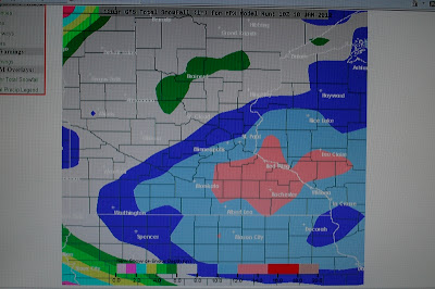
Updated snowfall forecast map

Here is the updated snowfall forecast map for the rest of today....This map does not show the forecasted storm total...Had this forecasted amounts to the amounts already picked up.....Radar showing Mod to heavy snow falling in parts of Barron County and points North.This should start to tapper off in the next hour or so..Light snow is slowly ending over my Western and Southern FA....

Snowfall forecast.

Area of low pressure is forecasted to become stronger as it heads into Northeastern WI....This will keep the snow going for a few more hours across much of the FA...However it should start to end out in my Western areas....The map below is an overall view....There may be some changes to this, as noted on the Map..One thing not noted on the map is..My Western areas may have to be dropped down in snowfall amounts for today.....

Snowfall amounts as of 11:00 AM

3.50 inches of snow has falling here at the office,and throughout the Central and Northern parts of Barron County.....Snow is still falling.....Other reported snowfall amounts,Cumberland 3.25,Rice Lake 3.00,Haugen 3.50,Turtle Lake 2.00.....

Friday, January 20, 2012

20 below last night!

Here at the office we hit -20.3 for an overnight low...Some other overnight low temps are as follows.
Hayward  -21
Superior -9
Rusk County -15
Eau Claire -12
New Richmond -13
Cumberland  -11 think this is to warm
Rice Lake -13 think this is also to warm
Price County -18
All the above came from Airports except our office reading...
Some readings from our observers....
Brill -21
Haugen -20
Tergo -21
Siren - 18 Airport reported -13

Thursday, January 19, 2012

20 below tonight!

20 below is looking more likely for tonight...Already down to -10.6 @ 6:40 PM......See no reason why my Central and Northern areas won't hit -20 or colder with the fresh snow cover and lighter winds, Meanwhile my Southern areas could get as cold as -15 as they have little to no snow cover.

Arctic air in full swing.

Arctic air is camped out over the area.....Lows here at the office dropped to -16.9..At 10 AM we are still sitting at -12.1...Hayward also dropped to -16....Superior bottomed out at -15....Eau Claire saw -11...Osceola -13....New Richmond also came in at -13...Cumberland -13...Siren saw -15 Rice Lake saw -13.....Will be lucky to get above zero in my Central and Northern areas today....While my Southern areas should barely break zero....Tonight will be another bone chilling night...With lows ranging from
-20 to -10...

Wednesday, January 18, 2012

GFS model

Wow this is sure way off! another reason why I don't use these maps! GFS has been so wrong this year....One it tracks the storms way to South and Southeast. 2 if it does track a storm with EC,GFS overs estimates totals...I don't think it was it right all this winter with totals....

Weather 4 You

Weather 4 you is now up and running. Forecasts will slowly get going for now just did more so a briefing type forecast. Weather 4 You is your number one choice for the best forecast and information,besides the NWS!!!! Our slogan will be. Want the best weather forecast/ Weather 4 you, is for you.
The Weather Center has the link on the right hand side.
Forecaster/Paul.

Arctic cold front position

The map below shows you were the Arctic cold front is right now.....Say goodbye to the warm air we had today, temps today were below normal...Highs at the office was 19 average high is 21....

Say goodbye to the warmth

Here comes the Arctic cold front....Hope everyone was able to enjoy the warm day temps at the office hit only 19 today......Look at this afternoon temps behind the Arctic cold front....That shall be our weather very soon!!....Light snow/ flurries are breaking out along the frontal boundary....

Forecast for Western/Northwestern WI

Forecast problems..Will be the Arctic temps and wind chills today through Friday night….Also a few shots of snow….No long term forecast will be issued, as confidence levels are so low that far out.


***CURRENT CONDITIONS***

At 11 AM skies range from mostly sunny to partly sunny.Temps range from the single digits to as warm as 18 over in Oseola which does seem a little warm…..Wind are from the S/SE from 3 to 12 MPH with gust ranging from 18 to 23 MPH.

***FORECAST DISCUSSION***

Arctic cold front will slam through the FA during the coarse of today…..Temps won’t warm to much, Winds will switch from the S/SW to the W/NW later wind from 10 to 20 MPH with gusts up to 30 MPH will be possible….This will lead to very cold wind chills ranging from -20 to -30 tonight…..Will alos be a chance of light snow as the Arcitc blast moves in…Thursday shall be dry but cold highs may not get above zero for my Central and Northern areas, and only to the single digits arcoss my Southern areas….Friday a clipper will bring another chance of snow….Still no big deal and inch may be possible….Have kept snow chances going right through tis whole forecast package as the fast westerly flow keeps on giving…To hard to time systems…Looks like no big snow storms now……Just light snow fall amounts off and on….

***YOUR SHORT/MIDDLE TERM FORECAST***

TODAY….Becoming cloudy a chance of light snow later this afternoon….Highs 15 to 20…Winds S/SW becoming W/NW 10 to 20 MPH with gusts up to 30 MPH.

TONIGHT…Light snow ending, slowly becoming party cloudy. Lows -20 to -15 Central and Northern areas, single digits Southern areas….W/NW 10 to 20 MPH with gusts up to 30 MPH.Wind chills values ranging from – 30 to -20.

THURSDAY…. Cold,sunny…Highs -5 to 0

THURSDAY NIGHT….Clear cold… Lows -15 to -10

FRIDAY THROUGH SATURDAY… A chance of snow…Highs 5 to 10 Fri…15 to 20 Sat….Lows -5 to 0 Fri….10 to 15 Sat.

SUNDAY THROUGH TUESDAY…. A chance of snow…Highs middle to uper 20s to around 30… Lows 10 to 15 most of this time frame…15 to 20 by Monday night.

***LONG TERM FORECAST DISCUSSION***

Will be short and to the point….Models are way off and to try to make a forecast is pointless….This has to be the worse I have seen them in many years…..One says it will warmup big time,while others say it will get colder again…Some say snow storm, other say no snow….. Again it is pointless even trying to figure it out….Will give the long term models a few days to resolve this,then will issue a long term forecast…..

Cold night last night

Winter made a strong come back...Temps throughout much of the FA saw temps fall well below zero....While my far Western areas stay a few degrees above zero....Below are some of the lows....
Here at the office -10
Rice Lake Airport -5
Superior -8
Eau Claire -3
Hayward the winner they dropped to a bone chilling -15...
Temps have warmed to just above zero through the FA....

Friday, January 13, 2012

Weather 4 you

I'm happy to say I got my blog online today with some help from Dirk.I will still be doing forecasting and short term forecasting for The Weather Center. The link can be found to the left and below this.
My blog is called Weather 4 You. I won't be forecasting on it for a week or two. I need to add more things to it before I get to far ahead of myself. I will be back at Dirk's tonight to work on it.
http://pauljones822.blogspot.com/

Thursday, January 12, 2012

Forecast for Western/Northwestern WI.

Forecast problems…None really to speak about untill we get into the long term…Winter is back and will last for awhile, though we will have a few warmer days here and there.The main story will be the cold air throughout next week.Then the coldest air of this winter thus far coming in the longer term.....With a possible winter storm...See long term discussion and forecast for that info.

***CURRENT CONDITIONS***
At Noon…Temps are in the lower to middle teens under cloudy skies most stations are reporting light snow…New Richmond and Osceola are not reporting light snow… Winds are from the North/Northwest from 9 to 15 with gusts up to 23 MPH…..

***SHORT TERM FORECAST DISCUSSION***
Light snow will keep going through the rest of the day….Accumulations will be light ¾ to as much as an inch is possible…Thinking the lower end of that will verify….Higher amounts of snow will be found along parts of the Lake Superior South Shore….Where as 2 to 5 inches more of snow shall fall today and tonight…….A 993 MB low pressure system over Central MI is forecasted to pull East/Northeast. This will also drag a trough of low pressure out of the FA tonight…Friday we get a break in the action, however temps will remain well below norms….A 1024 MB high pressure is forecasted to nudge into the area tomorrow, this should allow for skies to become partly cloudy..This will allow for lows Friday night to dip to below zero for a few hours…WAA should get in late Friday night/early Saturday morning…Temps could raise by sun’s up…Saturday a clipper system is forecasted to be over Northern MN this low will draw a warm front Northeast wards, however that will be short lived as this system will drag another cold front into and through the area…..
***YOUR SHORT TERM FORECAST***
REST OF TODAY. Cloudy with light snow/flurries likely…Less than an inch, higher amounts along parts of the South Shore….Highs today 10 to 15.
TONIGHT… Cloudy with a chance of light snow/flurries ending. Still will be LES snows in the snow belts of the South Shore…Skies may start to clear off after 2 AM…. Lows -2 to +3.
FRIDAY/FRIDAY NIGHT…. Partly cloudy highs 10 to 15 lows -5 to 0.
SATURDAY…. A chance of light snow under cloudy skies highs 27 to 30.
SATURDAY NIGHT.. Cloudy then becoming partly cloudy lows 5 to 10.

***CONFIDENCE LEVEL*** = High for this time frame.

***MIDDLE TERM FORECAST DISCUSSION***
Sunday a high pressure system builds back into the area, this will insure the FA a Partly cloudy day with warm temps….Once again this will be short lived as we see another system, unlike Saturday’s this system this one is forecasted to move along the Canada/USA border…A low pressure system is forecasted to form in KS and push Northeast wards to Northeastern part of MI….Will have a slight chance of snow for Monday/Monday….Models still all over the place on this…..One thing is for sure an Arctic cold front is forecasted to blast through the FA Monday late afternoon/early evening….This could bring us the coldest air thus far this winter…..
***YOUR MIDDLE TERM FORECAST***
SUNDAY/SUNDAY NIGHT…. Partly cloudy highs 25 to 28 lows 15 to 18.
MONDAY/MONDAY NIGHT…. Cloudy with a slight chance of snow highs 27 to 30 lows 5 to 20.
TUESDAY/TUESDAY NIGHT…. Partly cloudy highs 5 to 10 lows -10 to -5.
WEDNESDAY/WEDNESDAY NIGHT…. Partly cloudy highs 5 to 10. Lows -15 to -10.

***CONFIDENCE LEVEL*** = HIGH on temps. Low of snow chances for Monday.

***LONG TERM FORECAST DISCUSSION 19TH THROUGH 28TH****

We start this time frame dry and cold…Could be some flurries and light snow in our Southern areas on the 19th…There is another storm system that is forecasted to stay well to our South on the 20th and 21st ,another system os forecasted to drop into the area on the 22nd this looks like it could bring a better chance of snow to my Central and Northern areas.Warm air will try to work North on the 23rd, however there looks to be a chance of heavy snow for my Central and Northern areas, with a chance at rain/wintery mix in my Southern areas..Will keep a chance of snow going on the 24th . A slight chance of snow for my Central and Southern areas on the 26th /27th doesn’t look like nothing more than light snow/flurries. The 28th dry. So off and on chances of snow through this time frame….Temps for the most part will be colder than normal, with a few warm days, overall will see an average of below normal temps.
***YOUR LONG TERM FORECAST***
19th. Dry highs 5 to 10 lows -5 to 0
20th. Dry highs 5 to 10 lows -10 to -5
21st. Dry highs 0 to 5 lows -10 to -5
22nd. A chance of snow highs 5 to 10 lows -5 to 0
23rd Snow and it could be heavy Central and Northern areas, rain and wintery mix in the Southern areas than changing over to light snow/flurries….High 20 to 25 lows 5 to 15
24th Chance of light snow highs 10 to 15 lows -15 to -10
25th Dry highs 0 to 5 lows -15 to -10
26th Slight chance of snow Central and Southern areas dry Northern areas. Highs 10 to 15 lows.-10 to – 5
27th. Slight chance of snow Central and Southern areas dry Northern areas highs 5 to 10 lows –20 to -15
28th Dry highs -5 to +5 lows -20 to -15

***CONFIDENCE LEVELS*** Moderate to high through this period.

Snowfall amount

We have 3.75 inches of snow so far from this storm event....Still snowing....Here is a picture from on of my snow broads,This was is showing a little more, however when one averages out all the snow broads and the snow gauge one would get 3.75...This is not the grand the total yet.

Sunday, January 8, 2012

A closer look at the buds!!!

These are buds!! If they aren't then I must be dead!!.....

Pictures of a sugar maple and my lilacs budding out

Who says tress can't bud out this time of year?....Proof is right here that indeed they can....Not the first time I have seen this in my lifetime.....What is cool we still have snow on the ground here.First picture is the Sugar maple.
Next two pictures is my Lilac bush.


Saturday, January 7, 2012

The forecast for Western/Northwestern WI.

Forecast will mainly deal with the weather pattern change that is coming next week.. It will be a big one!! Just as we have been forecasting for sometime now.....


***CURRENT CONDITIONS***
At 1:00 PM Skies range from Partly sunny to mostly cloudy throughout the FA…Temps range from the upper 20s to lower 30s….Winds are out of the West/Northwest from 5 to 9 MPH.

***SHORT TERM FORECAST DISCUSSION***
Short wave that moved through the area during the overnight has now pushed into Eastern WI…Some clearing has taken place behind this…Still some more clouds out over Central/ Northern MN to work either way into the area…Have decided to run with partly cloudy to cloudy wording in the forecast, this will cover today rather well. Temps will be a tad cooler today as CAA has over taken the FA…Still temps will be about 20 degrees above normal. Later this afternoon or evening we will see another short wave drop into the area from Canada…This wave will be a fast hitter with just clouds, no moisture for it to work with so no snow is forecast…..Sunday a high pressure system drops into the area this will allow for skies to start to clear after 2 AM setting the stages for a mostly sunny day tomorrow and Monday….A warm front is forecasted to blast through the area Monday night this will allow for warmer reading on Tuesday…The way it looks record highs for Tuesday should be safe….Record high is 44 degrees …We are forecasting lower 40s…..Either way it will be another warm day in the Northwoods…..

***YOUR SHORT TERM FORECAST***
Today… Partly cloudy to cloudy, highs 30 to 33.
Tonight… Becoming cloudy early, lows around 20 to 24….Becoming clear after 2 AM.
Sunday… Mostly sunny, highs 29 to 33.
Sunday Night… Partly cloudy to clear, lows 20 to 24.
Monday… Sunny, highs 35 to 30.. Lows 20 to 24.
Tuesday… Partly cloudy to mostly sunny, Highs 35 to 40, lows 24 to 28.
Confidence level is moderate to high…

***MIDDLE TERM FORECAST DISCUSSION***
Big changes forthcoming in the weather pattern we have been locked under….With a chance of significant snowfall for my Central and Northern areas for Wednesday and Wednesday night..For now will run with a chance of snow, thought about running with snow likely wording as ECMWF model has showing this strong storm system the last few days now……..Then a blast of Arctic air….
ECMWF model forms a low pressure over ND/SD then tracks it to the Southeast to around the Twin Cities areas then through Central WI Wednesday and Wednesday night..GFS has been an outlier so will disregard it…..
Should be plenty of moisture for this strong low pressure to work with cold air throughout the column to keep prcip all snow through my Central and Northern areas. My far Southern areas could see some light rain before changing over to some light snow, as of right now precip chances are slim at best down there…One thing that is a giving for the whole forecast area will be the Arctic blast….We may have our lows on Thursday night to warm, we may have to drop them below zero… Will depend on if we get a good snow pack, and how fast clouds clear out…Still time to play with that…

***YOUR MIDDLE TERM FORECAST***
Wednesday… Cloudy a chance snow highs 25 to 28 then falling in the afternoon….
Wednesday Night… Cloudy with a chance of snow lows around 5 to 10.
Thursday… Mostly cloudy highs 10 to 15.
Thursday Night… Mostly cloudy lows 0 to 5.
Friday…. Partly cloudy highs 13 to 16….
Confidence level is rather high through this period.

***LONG TERM FORECAST DISCUSSION SAT 14 THROUGH MON 23**

Temps will highly depend on how much of a snow pack is on the ground…So as of right now we could be to warm with the long term temps…Though through most of this time frame we are looking at below normal temps…
There will off and on chances of snow throughout the period….So the weather pattern will have changed to colder than normal from the middle term into this forecast cycle…

***YOUR LONG TERM FORECAST***
Sat 14….Dry highs 15 to 20 lows 5 to 10
Sun 15… Dry highs 15 to 20 lows -10 to -5
Mon 16… Slight chance of snow highs 10 to 15 lows -5 to 0
Tue 17… slight chance of snow highs 15 to 20 lows -5 to 0
Wed 18.. Dry highs 10 to 15 lows -5 to 0
Thur 19… Dry highs 5 to 10 lows -10 to -5
Fri 20… Slight chance of snow highs 10 to 15 lows 0 to 5
Sat 21.. Slight chance of snow highs 10 to 15 lows 0 to 5
Sun 22... slight chance of snow highs 15 to 20 lows 5 to 10
Mon 23... Dry highs 20 to 25 lows 10 to 15.
Confidence level is low on temps and precip chances… As stated above temps will be highly depend on the snow pack…I did undercut model guidance through this forecast cycle to account for the snow pack.
Normal highs through this period...20 to 21....Normal lows for this period...1 above..
Monday, January 2, 2012

Looking back at 2011

This data is for Barron County WI only….
This was one wild year in terms of the weather…..
We will looks at how much snow has falling in this past year….This may be a little confusing, as we will look at every month we have snow….
We will look at how many thunderstorm days we had.
We will look at how many severe thunderstorm days we had…

First off we will look at the crazy temp ride we had…

Many call the year 2011 a year without a spring….Well they were sure right about that….From Jan through July temps averaged well below normal….
We even had snow in May more on that latter.

Time to list the months and what we saw…..

***JANUARY***

Temps were colder than normal…We had 22.50 inches of snow…No thunderstorm/thundersnow days.

***FEBUARY***

Temps were colder than normal….We had 12.50 inches of snow….No thunderstorm/thundersnow days..

***MARCH***

Temps averaged out to be colder than normal….We had 14.00 inches of snow…We had 3 thunderstorm days…

***APRIL***

Temps were colder than average….We had 7.50 inches of snow…We had 3 thunderstorm days… 1 severe thunderstorm day….Total thunderstorms were 4.

***MAY***

Temps were colder than normal….We had snow on the 1st and 2nd only a trace, nonetheless it was snow…We had 5 thunderstorm days…We had 2 severe thunderstorm days…Total thunderstorm days 7.

***JUNE***

Temps did average out slightly below normal, even though we had 102.7 on the 7th First part of June was warm, however temps cooled right back off for the rest of the month. We had 10 thunderstorm days…No severe thunderstorm days…Total thunderstorm days 10….

***JULY***

Temps were slightly cooler than normal..What was strange about this month was our overnight lows were warmer than average, while our daytime highs were cooler than normal…..We had 9 thunderstorm days…We had 6 severe thunderstorm days..Total thunderstorm days 15…

***AUGUST***

Temps were near normal still slightly below normal….We had 8 thunderstorm days…We had 1 severe thunderstorm day…Total thunderstorm days 9….

***SEPTEMBER***

Temps were slightly below normal…. We had 4 thunderstorm days….No severe thunderstorm days…Total thunderstorm days 4….We had a trace of snow on the 15th.

***OCTOBER***

Temps were warmer than normal….We had 2 thunderstorm days….No severe thunderstorm days….Total thunderstorm days 2… We had less than ¼ inch of snow on the 27th.

***NOVEMBER***

Temps were warmer than normal….We had 4.50 inches of snow….We had 1 thunderstorm day which was thundersnow….. Total thunderstorm days 1.

***DECEMBER***

Temps were warmer than normal…. We had 18.50 inches of snow…No thunderstorm days…Our first subzero readings happened this month….on the 9th and again on the 10th
***RECAP***
Temps for the year 2011 believe it or not were slightly below to near normal….
We had a total of 55 thunderstorm days…Out of those days we had 10 severe thunderstorm days..
We had 79.50 inches of snow for the year 2011……….
There you have it 2011 review…..
ONCE AGAIN THIS IS FOR BARRON COUNTY WI ONLY….THIS INFO COMES FROM OUR RECORDS HERE AT THE WEATHER CENTER……

Looking back at December 2011

Looking back at the month of December….

December was a warm month…..Still be had some nights that we saw temps drop below zero…..Over all this December will average out to be slightly above normal for the area.

The was 7 snow days this month…..Days that we had saw snow fall are as follows.

1st …. 1.00 inches.

2nd …and 3rd …. We had 8.00 inches.

14th… we had ¾ inches.

23rd …. We had 3.00 inches.

29th we had ¾ inches.

31st we had 5.00 before midnight…

This brings the total snowfall amounts to 18.50 inches for this month.

December 2010 we saw 33.75 inches of snow….

Let’s break the snowfall down more and compare it to the average.

On the average we see 12.80 inches of snow in December…..So we did manage to see above normal snowfall….18.50 – 12.80 = 5.70 inches above normal

There was no thunderstorms or thundersnow days this past month….

Late this afternoon or evening we will look back into the year of 2011…..

Sunday, January 1, 2012

Storm report and pictures

As forecasted the heavier snows did fall through Northern Barron, Polk, and Rusk Counties and points to the North/Northeast of that area....The highest snow amounts have been found over the South Shores of Lake Superior....
Here at the office we picked up 6.00 inches of snow, that amount may have been higher, however didn't get a chance to take another reading as I was out of the office most of today....Winds have been gusting up to 45 MPH here at the office over the last hour....Still areas of blowing and drifting snow will remain a problem for parts of the FA.
Here are some pictures from last night and today....Videos can be found on youtube...See link to the right.