Saturday, December 31, 2011

Possible winter storm for the area.

Problems with this forecast…Computer models really aren’t agreeing on the track of the storm system…GFS has the system Moving into Southern IA then into Central IL before working it into IN…..Meanwhile NAM has the low moving into Northeast IA/Southwest WI Before tracking it to around the Door County area…..What both models do agree on is that the area of low pressure will become stronger as it pushes East of the area…..EC has a track close to the NAM, however just a tap North, either way once again this should not play accumulations …..Also EC does deepen the low once it moves past the area…..With models agreeing on that…This system should turn out to be a wind jammer……Wind could gust up to 40 MPH at time throughout the FA…Wind could gusts up to 45 to maybe as high as 50 MPH in our wind prone areas…..This will cause problems for high profile trucks, and vans…


Now as far as snowfall amounts….Models aren’t really seeing eye to eye….So have decided to blend NAM and EC models for the snowfall amounts I have threw GFS out the window as it can’t seem to handle any snowfall amount this year!.....The highest total will be along the South Shore of Lake Superior, where there could be 10 plus inches of snow, mainly due to LES…..The 5 to 8 inches snowfall areas also have a chance for some LES this is the reason for them amount versus going with 3 to 6 inches…..

Tonight and tomorrow some areas could see near to blizzard conditions with winds gusting 35 to 45 MPH throughout the area…Winds along with heavy snow falling, this could lead to blowing and drifting snows, which could cause travel problems later tonight into Sunday late afternoon or Sunday evening.

Also noted in my far Southern areas there may also be more of mix prcip which could hold snow totals down….There will be some mix prcip as the system first cranks up, however this will be changing to all snow rather fast for my Central and Northern areas….

Sunday, December 25, 2011

Merry Christmas!

From The Weather Center, we wish you and your families a very Merry Christmas!

Friday, December 23, 2011

Today's snowfall

Today we picked up 3.00 inches of snow here at the office....Snowfall ranged from 1 to 3 inches across the FA....A white Christmas for the parts of the FA...Won't melt tomorrow like a lot of people think it will...Temps ranging from 28 to 33....


Wednesday, December 21, 2011

Why one needs to use different radars.

Here is a good example as to why one needs to use different radars to see where precip may or may not be at….One radar grab is from DHL, the other is from MPX….One can clearly see the difference on these two radar views.

Monday, December 19, 2011

Some info.

Still won't issue a forecast...Short term forecasts have been covering things rather well..So will keep doing that...No big cold snaps or big winter storms seen right through Christmas....The end of the first week on the New Year still looks like a big weather pattern change coming to the area....

Saturday, December 17, 2011

Big changes in the weather coming/some interesting weather facts.

Looks like a big change in this boring weather pattern is coming in January…Looks like either the end of the first week or the start of the second week of January….So if you love this warm weather get out and enjoy it the next couple of weeks…..Snow lovers hang in there your time is coming very soon!!.....

Some interesting facts about the weather for Rice Lake WI…
Our warmest month is July.
Our coldest month is January.

Our windiest month is April.
Our Calmest month is August.

Snowiest month is January.
Months without snow are as follows….June, July, August…Snow has been reported in all other months.

Our wettest month is August.
Our driest month is February.

Our Sunniest month is July.
Our cloudiest month is November.

This is all based on averages….

Looking back at Nov 2011

I know am late with this….Nov was a up and down ride in temps and precip….Overall temps were slightly above average here at the office….

We a total of 4.50 inches of snow..

Snow days are as follows…

Nov 10… We had 1 inch.

Nov 19… we had 3 inches.

Nov 30… we had ½ inch…
Total snowfall...4.50 inches

We also had one thunderstorm day.

Nov 15. We had a thunderstorm this was thundersnow…

So we had one thundersnow day……

Looking back at  Nov 2010

We had 11 inches of snow…

We had 1 thunderstorm day/thundersnow day.

Thursday, December 15, 2011

Precip report

This picture shows we pick up 0.42" of precip from 7 AM yesterday through 7 AM this morning...
This is melted down...So rain/sleet and snow for this total....See post below for how to read the gauge the right way! Does make a big difference if one reads the top line,which is the wrong way....I do know some who read their gauge like that...A big NO, NO....

Wednesday, December 14, 2011

Water content

Here is the total water content of the snow/sleet/rain fall through 7 AM this morning.
You have to read the bottom line, as the water fills up the tub, the liquid will curve....This is aka meniscus....One has to read the bottom/base of the curve or the meniscus to get an accurate reading.Here is a picture....So here I have 0.16 of water....The reading won't be 0.17 as most would think....Just a fast lesson in reading a rain gauge....

Snow/sleet/rain

This morning has brought us a wintry mix of snow/sleet/rain....Here at the office we picked up 3/4 inches of snow with sleet....Roads are slippery this morning throughout parts of the area..... Here are a couple of pictures....

Friday, December 9, 2011

Below zero already

1.4 below right...Last night we hit 5 below...Looks like tonight should be the same story....A nice little warm up on the way for this weekend...Don't worry snow lovers we will not melt all the snow!!...
The mid to end end of next week is really looking interesting...Major snow storm is looking more likely...Still this is far out there and won't worry about it....Though looks like this system will have warmer air to work with....So the way it looks right now my Southern areas should see all rain...Central areas rain/snow mix....My Central areas in the Central areas should see all snow as well as my Northern areas...Will go in depth on this Sunday or Sunday night...For now will let models play their little games....GFS is playing the to far and East game though its 18z runs were closer to the ECMWF....I did use the ECMWF as it has been showing the same track over the last few days....Like always this model has done great on this years winter storms so far...GFS well it sucks....So will run with EC, one can't throw out it's track record from last winter and this winter so far!!....

Below zero....

There we have it our first below zero reading of this winter 2011/2012....At 12:19 AM we dropped to -1.3 degrees.... Now we are at -2.0 degrees...

Sunday, December 4, 2011

Still plowing the roads

A small video clip from on the way back home....Should have been out long before this....Still got some action.
http://www.youtube.com/watch?v=41iKCzqZCI4

Pictures from last night's snow event

I didn't take a reading yet, wanted to get pictures in case the wind becomes stronger...Great photo ops up here....


Saturday, December 3, 2011

updated snowfall amount

Almost up to 7.50 inches of snow.....

5.00 inches of snow.

5 inches of snow as of 8 PM still snowing very hard.

Still snowing very hard

Here are some more pictures from tonight's snow event.


3.00 inches

Picture says it all and it's still snowing very heavy.

Heavy snow falling at the office.

Heavy snow falling at the office we have 3 inches so far,still snowing heavy.


Updated snowfall map

Here is the current thinking on the lastest snowfall amounts...See discussion below for the details....

Fast discussion on today's and tonights snow event.

Will leave fine tune the snowfall map some in a little.....However the dark blue shaded area looks like 4 to 6 inches will be more likely with some iso areas seeing 6 to 8 inches...That is if stronger instability can move in, this will depend on how strong the thunderstorms down to the South can become...The deformation areas does setup more to the North...From the Twin Cities over Eau Clarie Rice Lake and Ladysmith area....A dry slot if forecasted to move into Southeast MN and Southwestern WI so with our snowfall map those areas should see from 2 to 5 inches of snow....That areas would be from Rochester MN over around the Nesillsvile area of WI. Some areas with that area could see some 6 inches reports,however rule off thumb is to run with 2 to 5 inches of snow....

Friday, December 2, 2011

Updated snowfall map

In the dark blue is where we are forecasting snowfall amounts of 6 plus inches. We did talk about adding some 8 inch snowfall amounts in that area, however it does not look like a widespread deal,just a few reports of 8 inches may been seen,however 7 inches would be more the realm. The red area we are calling for 2 to 5 inches. The light blue 1 to 2 inches. This system is still not 100% written in stone yet so Dirk may have to change this map tomorrow morning. This snowfall amounts may be less if strong thunderstorms form to the South down over MO and so on.Just another reason why we didn't go higher in the forecasted amounts. Southern areas may also see less if this system moves 50 miles West/Northwest,as this would allow for more warmer air to drawn into those areas keeping more of a mix percip going.Still a lot of things to keep an eye on with this system. Can't stress this enough, this winter storm is not wriiten in stone in any shape or form yet.By tomorrow morning Dirk should have things all worked out. I rather hold off on issuing a forecast at this time due to reasons stated above.I was one the fence about updating the snowfall map I would have rather waited for the 0z runs to come in. I'm almost sure this will end up going back to the first map that was out on Wednesday.
Forecaster/Paul.

Thursday, December 1, 2011

A weeee little chilly

A chilly night as of 10:52 PM it is 8.5 degrees....Good ice making weather...I sure hope we don't get any snow for about a good week or two!!!

Forecast will stand. Snowfall map will stand.

Am going to leave the ongoing forecast stand as is...Models today really not helping much,GFS still is way to South with the track of this system,While NAM and ECWMF have been hold the same track over the last few days...I really don't like Nam's output for QPF....However ongoing forecast and snowfall map was based more in the line with the ECWMF with a blend of NAM's QPF....The Gem model really hasn't been useful either....9 chances out of 10 I'm going to hold off on doing any major changes to the ongoing forecast, if needed it will be done tomorrow evening...Some of GFS memebers are slowly coming around to some with this storm system,seems like GFS is battling it's self now....Will leave snowfall map stand, there was some discussion about lowering some amounts way up North, and going an inch or two higher in the  South...Still looks like warm air may sneak into the far Southern areas to bring a mix on Saturday, and may even be a few hours of just plain rain in that area.This will hold down snowfall amounts...Central and Northern areas will be cold enough through the colum to produce all snow...
***TO RECAP***
Ongoing forecast stands..Snowfall map stands.... No changes are planed to the forecast....Changes will likely be map to snowfall map, reasons above...

This morning's pictures

Here are a few pictures taken this morning...We picked up an inch of snow from this system.


Below is the snow water equivalent.

Pictures from last night and this early morning snowfall

More pictures will be added once I get some in the day time later today.


Wednesday, November 30, 2011

Snowfall forecast.

This is our snowfall forecast for this upcoming weekend...This could change,but based on model data this is how it looks as of right now....NAM and ECWMF model are in good agreement on the track of the storm system, meanwhile GFS is way to South and Southeast....Would think we should see GFS get on track with the other models by Friday....Map made from a program,The program still has a few bugs to workout yet.

Forecast for Western/Northwestern WI

Light snow likely for tonight and tomorrow morning…Than heavy snow possible for the weekend mainly Saturday and Saturday night..Then Arctic air later in the short and middle term, along with the long term forecast…Which will not be issued today do to time.


***CURRENT CONDITIONS***
At 10 AM Skies are partly cloudy to cloudy…Temps range from the upper 20s to lower 30s…New Richmond is reporting 34 that may be wrong when looking at other stations….Winds for the most part are light from the South/Southwest

***SHORT/MIDDLE TERM FORECAST DISCUSSION***
This morning’s SFC weather charts..We see an areas of high pressure from TX up to the Great Lakes…A cold front is in Northwestern MN through Central ND….A weak area of low pressure is centered North of central MT a cold front extends South/Southwest from said low into Northern CA…By tonight the cold front is forecasted to pushing through the area. A low pressure system is forecasted to move along the frontal boundary From Mt into Western MN than the Northern Twin Cities through Southern Polk Barron than over to Door County….System is rather weak, however there shall be enough lift and moisture to kick out some light snows…. Looks like 1 to 3 inches will be possible mainly over my Central and Northern areas, mainly North of the storm track with 1 an inch possible over my Southern areas…Far Southern areas could see ½ of snow.
We get a break in the action for Late Thursday through Friday…Now onto the possible winter storm for the weekend….
ATTM there are still many things that could go wrong with this system….On Friday we will see the area basking under a high pressure…A strong cold front is forecasted to over Central MT back into ID and OR..We will find a storm system forming over the TX panhandle…Cold front is forecasted to move into and through the area on Saturday, this does slow up some as it gets just East of the FA…This will allow for the storm system to our Southwest to ride Northeast along the frontal boundary… This will allow for a band of heavy snow form South Central MN in the FA..Moisture shouldn’t be a problem as this storm system will drag up plenty from the GOM….Cold air will be in place, however there may be some issues as far as all snow or rain and snow mix in my far Southern FA before it changes to all snow…This could hold amounts down in those areas…..Now if the push of cold air moves faster than forecasted this would throw the cold front into Eastern WI, hence the low would be way to the East…If this pans out the Central and Eastern WI would see the heavy snows… Still tons to work out on this system….For now am going to run with first track of this system….Either way this system will be a fast hitter…Sunday we should see mostly sunny skies before a clipper like system brings in a shot a light snow, and more cold air.

***YOUR SHORT/MIDDLE TERM FORECAST***

TODAY. Increasing clouds. Highs 30 to 35

TONIGHT. Cloudy snow likely. Snow accumulations from half to an inch possible. Lows 27 to 30.

THURSDAY. Cloudy snow likely. Snow accumulations one to two inches possible in the morning. Highs around 30.

THURSDAY NIGHT. Clear lows 10 to 15

FRIDAY. Sunny highs 24 to 27

FRIDAY NIGHT. Clear lows 20 to 25

SATURDAY. Cloudy a chance of snow, highs around 30

SATURDAY NIGHT. Cloudy a chance of snow, lows around 20

SUNDAY. Partly sunny highs 20 to 25

SUNDAY NIGHT. Partly cloudy than mostly cloudy with a chance of snow lows 10 to 15

MONDAY. Cloudy with a chance of snow highs 20 to 25

MONDAY NIGHT. Mostly cloudy cold lows 5 to 10

TUESDAY. Partly cloudy highs 17 to 22

NOTE THERE WILL NOT BE A LONG TERM FORECAST ISSUED ATTM, AS TIME DOES NOT ALLOW FOR IT.

Thursday, November 24, 2011

Thanksgiving weekend forecast for Western/Northwestern WI

Forecast will stand for now. Previous forecaster did make a few changes…..Will leave them stand….We still have to keep an eye on Saturday’s storm system. If colder air can rush in soon enough, the rain still could mix with a changeover to all snow on Saturday…… If indeed this does happen a few inches of snow will be possible….


Today... will be a very nice day for the FA….. Highs today under sunny skies will range from the upper 40s North to upper 40s to around 50 in my Central FA..Lower to middle 50s in my Southern FA..

Tonight... Will star Partly cloudy skies throughout much of the FA….. Fog will be again possible up North… Lows tonight throttle back into the middle to lower 30s area wide…..

Friday... should be a cloudy day hence have lowered temps to range from the upper 40s North and Central to the lower 50s South….

Friday night... Rain moves into the area….Look for rain to be mixed with snow in our Northern parts of the FA, while plain old rain for my Central and Southern areas… Lows middle 30s up North, upper 30s Central. Lower 40s South.

Saturday.... Rain for most of the area….Will run with rain and snow North changing to all snow…. Will keep the Central and Southern area rain…May update this to add rain/snow mix in my Central area for Saturday as well….

Saturday night…. Snow North…Rain/snow mix than changing over to all snow Central…. Rain South with some mix of snow before ending…..

Sunday…. Looks to cooler under sunny skies Highs lower to middle 30s for the whole FA……

Note….Extend forecast will have major updates to it tomorrow…..

Temps at 9 AM range from the upper 30s to lower 40s….

Happy Thanksgiving everyone…..

Wednesday, November 23, 2011

Tweaked forecast some

Decided to tweak ongoing forecast. Main tweaking was done for Saturday. Will leave everything else intact.
So here is the latest thinking. Do to latest model runs I have decided to push the rain changing to snow to Saturday night. This system does not apear to be a big deal. Little or no snow accumulations are forecasted as of now.Colder air is forecasted to mix in a little to late with this system.System did look better on past computer runs,that flizzed out. So the Holiday travel plans should be in good shape with no major problems. Down in our far Southern forecast area the rain may not even mix with snow before it ends.Still think Dirk will have to fine tune all this tomorrow or Friday.
FORECASTER/PAUL.

The forecast for Western/Northwestern WI.

Forecast has been tweaked some.See Saturday and Saturday night. I did leave the forecast disucussion as is, see about for updated forecast short term forecast discussion for this weekend. Paul


Forecast problems…. Will be the cloud cover and areas of fog…Vis satellite shows most of the FA locked under clouds and fog…Some clearing noted over Burnett County, however more cloud back in MN… Thinking is to run with mostly cloudy to pc cloudy skies.. May be a storm system to impact the area for Friday night through Saturday evening…More detail on this below.


***CURRNET CONDITIONS***

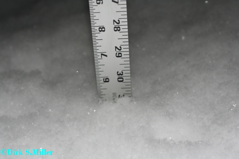
At 10 AM skies are cloudy at all stations with some fog being reported as well….Temps range from the middle 30s to upper 30s….Winds range from 7 to 13 MPH out of the Southwest….

***SHORT TERM/MIDDLE TERM FORECAST DISCUSSION***

Looking at the SFC charts we find a 1001 MB low pressure over Southern part of NY State with a cold front extending down into the FL panhandle than out into the GOM….This system should pose problems for parts of VT,NH, and ME for Thanksgiving day…Looks like that area could see 4 to 8 inches of snow…..Meanwhile a ridge of high pressure is still locked in place through the upper Midwest down into the Central and Southwestern States…..Large storm system is found over the Northwest Pacific Coast states….Fog and low clouds for today as we talked about earlier…..Still have a gut feeling that we should run with Mostly cloudy skies as we have a inversion in place the warm air aloft and the melting snow pack has been keeping us cloudy and foggy the last few days….Really see no reason why this won’t stay the rule for today…Models really aren’t doing so great with this….Thanksgiving day Am still banking on sunny skies…This will allow temps to reach into the middle to upper 40s throughout the FA…Most of the snowpack should be depleted by then…Record highs for Thanksgiving day is 55…That record should remain safe…There could be a few 50 degree readings in my far Southern parts of the FA….Cold front starts to drop into the FA for Friday so with more clouds around will lower temps from Thanksgiving day…Will run with lower 40s to middle 40s….Late Friday night and Saturday….Low pressure is forecasted to form along the cold front over the Twin Cities to EAU Claire…..Than is forecasted to move towards the Northeast….Will run with plain old rain for Friday night…Then mix and change the rain to all snow for Saturday for my Central and Northern areas…Will stay all rain in my Southern areas until late Saturday night then should see the rain mix with snow down there….There could be several inches of snow….Thinking is should be like last weekend’s storm system….Still to early to know for sure, model are in good agreement on it, some timing issues and the track is still a little unclear….If this pans out as the models are forecasting attm this system could have an impact of travel plans back home…We will need to watch this very close……Will not chance the forecast for Tuesday as models not have a good agreement of this next system see long term discussion for info on this….

***YOUR SHORT/MIDDLE TERM FORECAST***
WEDNESDAY. Mostly cloudy may see some breaks from time to time…Highs 38 to 43

WEDNESDAY NIGHT. Areas of fog partly cloudy.. Lows 28 to 34

THANKSGIVING DAY. Sunny highs 44 to 48

THURSDAY NIGHT. Increasing clouds, lows 30 to 35

FRIDAY. Cloudy. Highs 40 to 45

FRIDAY NIGHT. Cloudy a chance of rain. Lows 34 to 38

SATURDAY. Cloudy with a chance of rain. Highs 35 to 40 than falling.

SATURDAY NIGHT. Cloudy a chance of rain mixing with and changing over to light snow,Little or no accumulations. lows 25 to 30

SUNDAY. PC highs 30 to 35.

MONDAY. Partly cloudy 30 to 35.

MONDAY NIGHT. Cloudy with a chance of snow lows 23 to 26

TUESDAY. Cloudy chance of snow. 28 to 30

TUESDAY NIGHT. Chance of snow lows 20 to 25

***LONG TERM FORECAST DISCUSSION FROM THE 28TH THROUGH DEC 9TH***

Models have been all over the place on a low pressure system that is forecasted to form in MS…ECMWF moves the low Northeast.GFS on the other hand forms the low a little more to East/Northeast then moves the low to OH them retrogrades it back to the Northwest into Lake MI, GEM is more in the line of thinking as ECMWF…..So with this being so unclear we have decided not to change the first part of the long term forecast…Will give it a few more days to decide if we need to make changes…..Will keep a slight chance of snow going from the 1ts through the 4th as a cold front is swept into the areas from a deepening low pressure system to our North up in Canada. We may need to bump up the temps a little, again we won’t do that just yet as this is the first time one model is showing temps to be warmer, while the others keep the temps forecasted below the same...

***YOUR LONG TERM FORECAST***

30th. Snow ending highs 25 to 30 lows 15 to 20

1st . Slight chance of Snow highs 20 to 25 lows 15 to 20

2nd. Slight chance of Snow highs 20 to 25 lows 1o to 15

3rd Snow highs 20 to 25 lows 10 to 15

4th . Slight chance of snow highs 20 to 25 lows 8 to 13

5th.. Dry highs 15 to 20 lows 5 to 10

6th. Dry highs 15 to 20 lows 10 15

7th .Dry highs 15 to 20 lows 5 to 10

8th. Dry 20 to 25 lows 10 to 15

9th . Dry 20 to 25 lows 10 to 15.

Monday, November 21, 2011

The forecast for Western and Northwestern WI

Like the warm fall we have been having overall? Then you will like this forecast, snow lovers hang in there. Overall temps will be above normal with little rain or snow this week….Next shot of rain comes in about Friday, more details on that below…

***CURRENT CONDITIONS***
At noon skies are cloudy through most of the FA Ashland is reporting sunny skies as of now..Satellite does show this….Temps are in the middle 20s to lower 30s…..Winds are light from the S/SW.
***SHORT AND MIDDLE TERM FORECAST DISCUSSION***
Here is the SFC map.


Ridge of high pressure is sitting over head, however it remains cloudy as an inversion has also setup overhead….Should see more clouds than sun today….Will keep clouds in forecast for tonight…Temps going to be tricky where there is a snowpack temps will remain cooler than other areas…Temps should remain in check with tonight’s clouds however if any breaks do happen over the snowpack areas temps could dive into the teens…For now will run with upper teens to lower 20s. That should cover the bases rather well…..Tomorrow will run with partly cloudy skies to account for the Southern system as it may try to spread more clouds into the area RH fields off the 850 and 700 MB charts shows this rather well. Tuesday we see a and weak low pressure system over Canada this will start to drag a warm front towards and through the FA Wednesday….This will allow for temps to warn into the 40s could see some 50 degree reading in my far Southern areas…Looks like the record highs will be safe!. Thanksgiving day looks to be warm and sunny….Next chance of precip come in for Friday as a cold front slowly starts to work this way. Really not to thrilled about rain or snow chances attm…Temps will take a dive…. So to recap temps will be above norms this week and through the Thanksgiving weekend…Slight chance of precip…Holiday travel plans around the area look to be in good shape with no big rain or snow makers…..

***YOUR SHORT TERM/MIDDLE TERM FORECAST***

TODAY. Cloudy highs 30 to 35

TONIGHT. Cloudy lows 19 to 22

TUESDAY. PC highs 30 to 32.

TUESDAY NIGHT. Clear lows 19 to 21

WEDNESDAY. Sunny highs 35 to 40

WEDNESDAY NIGHT. Clear lows 24 to 28

THANKSGIVING DAY. Sunny highs 28 to 43

THURSDAY NIGHT. Increasing clouds, lows 30 to 35

FRIDAY. Cloudy with a slight chance of rain showers. Highs 40 to 45

FRIDAY NIGHT. Cloudy slight chance of rain mixing with some snow. Lows 30 to 35

SATURDAY. Cloudy rain mixing with and changing to light snow showers. Highs 35 to 40 than falling.

SATURDAY NIGHT. Cloudy light snow showers ending, lows 23 to 27

SUNDAY. PC highs 30 to 35.

***LONG TERM FORECAST DISCUSSION MONDAY 28 THROUGH WEDNESDAY DEC 7TH***

Confidence levels are really low if the precip forecast….Levels are a little better in the temps…..Long range models are showing a low pressure system to take hold of the FA starting Monday the 28th and traveling around upper Midwest through the 3rd of Dec…. Models want to cutoff this low…If this does indeed happen we could be looking a long period of snow…Temps are forecasted to fall well below norms through the long range…..Most likely this long term forecasted will be updated….

***YOUR LONG TERM FORECAST***

28th. Rain/snow changing to all snow…Highs 30 to 35 lows 20 to 25

29th snow may be mixed with rain off and on…Highs 30 to 35 lows 20 to 25

30th. Snow highs 25 to 30 lows 15 to 20

1st . Snow highs 20 to 25 lows 15 to 20

2nd Snow highs 20 to 25 lows 1o to 15

3rd Snow highs 20 to 25 lows 10 to 15

4th . Dry highs 20 to 25 lows 8 to 13

5th.. Dry highs 15 to 20 lows 5 to 10

6th. Dry highs 15 to 20 lows 10 15

7th .Dry highs 15 to 20 lows 5 to 10

Sunday, November 20, 2011

More pictures

I took these this morning here at the office...Still thinking about heading back North to get more pictures from up there,we shall see on that one....


8 deer in the above picture...

Saturday, November 19, 2011

11/19/2011 winter storm chase

Today was very interesting winter storm chase....I started at Trego and ended up heading to Gordon...Light snow started to fall around 12:19 PM just North of Trego....I decided to go further North...Once the heavy started it got very heavy very fast...Went to like 5 to 6 inches of snow like in a matter of an hour it seemed liked....53 was in bad condition before,well that very heavy snow made it worse....Snowflakes were big as half dollars...Could hardly see in front of you...The pictures I took in those conditions were nothing but crappy...All white...Would have been ok if I was close enough to buildings or something....Decided to head back South, as I didn't have nothing with me to stay the night any where....Saw lots of accidents one roll over by Spooner...Got home and now I'm able to post the pictures and videos from today....We ended up with 3 inches of snow back here at the office....


Video links below.

http://www.youtube.com/watch?v=0v8xXWB1qVQ