Thursday, October 27, 2011

Small vids from todays sleet and snow event

Here are some clips of the video I took day of the sleet and snow event we had this afternoon....
Can even mark down another thunderstorm day for October!
http://www.youtube.com/watch?v=3KZeG97-MvU
http://www.youtube.com/watch?v=SEMRvz9j8S4

rain, thunder,Sleet,and snow

We had it all today as the rain started there was some thunder with it...Rain changed over to sleet and some snow rather fast...Temps took a dive into the 30s once the precip started...Here are a few pictures from today.


Friday, October 14, 2011

October snow is it rare or not?

Snow in October, how rare or un-rare is it?


Looking back at the year of 2009 we had we had 5 snow days….Days that had snow days are as follows.

Oct 10… 1/4'”

Oct 12…. 3.30”

Oct 15… 2.00”

Oct 23 and early morning hours of the 24 for a total of….3.75”

Monthly total was 9.30” of snow for 2009..

See this link for October 2009 posts and pictures.

http://dirksforecastingcenter.blogspot.com/2009_10_01_archive.html

Look back at the year of 2010 we had 1 snow day.

Oct 27 we picked up ½” of snow…..

So really it is not rare to see snow in October, its rather normal…What is rare is the Halloween blizzard of 1991.. So don’t be fooled by anyone saying “snow in October is rare”

Forecast will stand as is

Forecast below will stand as is. No change is planed attm.

Wednesday, October 12, 2011

The forecast for Western & Northwestern WI.

Forecast looks to be a rather wet one starting this afternoon and lasting through Thursday evening….Then we shall get into another dry cycle from Friday through the weekend
Will bring a chance of showers back into the forecast early next week and hold the chances right through the first part of the long term forecast…Still feel there is no chance of snow in the upper Midwest, though ECMWF model is hinting at some rain snow mix for Monday night….Note this just showed up so I won’t jump on the wagon right now…We will keep watching trends to see if GFS model also switches to a Southerly track of this system….Thinking is if a rain snow mix is to occur it would be over far Northern MN…. We will watch this…..For now will leave snow mix out of the forecast!. The long term we do see our better chance at a rain mix snow for the 26th and early part of the 27th see long term dis.& forecast for that.

***CURRENT CONDITIONS***

At 11 AM radar is showing showers and thunderstorms over parts of MN.This areas of showers and storms is tracking toward the North/Northwest this should miss the area, however there is another batch of showers and thunderstorms over Eastern IA this is moving North wards this will effect the area later this afternoon.
Temps for the most part are in the middle 60s….Skies are partly cloudy, winds from the South from 5 to 12 MPH...
Here is the SFC weather map for today.


***SHORT & AND MIDDLE TERM DISCUSSION***

The main problem we will deal with during this period will be the first part then the later part…
One short wave moving North through MN this won’t effect the local FA….The next short wave is already moving into Southwestern MN…Meanwhile we find a low pressure system Just North of Central ND and a trailing cold front into Western MN down into far Northwestern KS. This cold front is forecasted to move into Cental MN this afternoon…This will bring in showers and thunderstorms….LI is running -1 to -2 along with Cape of 1000 to 1400 J/KG…..This system will be rather slow to move out,also another weak low/ short wave is forecasted to form over Southwestern IA..This is forecasted to run up along the frontal boundary into Southwestern WI early tomorrow morning…A secondary cold front is forecasted to push into the FA late Thursday night early Friday morning…So will keep showers ongoing through Friday morning, however will not run with thunderstorm wording after midnight tonight. Looks like everything is coming together for some healthy rainfall amount through much of MN and WI….Looks like 1.00” of rain will be likely from Washburn County down through Pepin County of WI, into Wabasha into Central Winona into Houston Counties of MN points West of this line should see from 0.25 up to 0.75 inches of rain….The winners of this rain shall be found from Parts of Rusk County down through Chippewa EAU, Clark, Jackson, Trempealeau La Crosse, Monroe,Vernon Counties of WI back in far Northwestern IA Counties…Here we could see rainfall amount close in on 1.25 to 1.50 inches of rain.
Friday this system clears the area, winds should be on the increase as we see some good mixing down could see winds gust close to 30 MPH for a time….The weekend looks to be dry and nice temps slightly below normal under pc skies….Monday should be dry for most of the day, Monday night we do see a chance of showers coming back into the forecast….

***YOUR SHORT & MIDDLE TERM FORECAST***

TODAY…. Showers and thunderstorms this afternoon…Highs 65 to 70. S/SE winds 5 to 10 MPH.

TONIGHT… Showers and thunderstorms before midnight, then showers lows 50 to 55. Light winds.

THURSDAY… Showers highs 55 to 60.W/NW 5 to 10 MPH.

THURSDAY NIGHT… Showers ending, lows around 40 W/NW 5 to 10 MPH.

FRIDAY…. PC windy highs 50 to 55. Winds W/NW 10 to 20 MPH with gusts from 25 to 30 MPH.

FRIDAY NIGHT… PC lows 35 to 40.

SATURDAY THROUGH SUNDAY NIGHT…. Partly cloudy highs in the 50s lows in the 30s to 40s.

MONDAY…. PC highs 50 to 55.

MONDAY NIGHT… Chance of showers lows 35 to 40

TUESDAY…. Chance of showers…. Highs 45 to 50 lows 30 to 35.

***LONG TERM FORECAST DISCUSSION THE 19th THROUGH THE 28TH ***

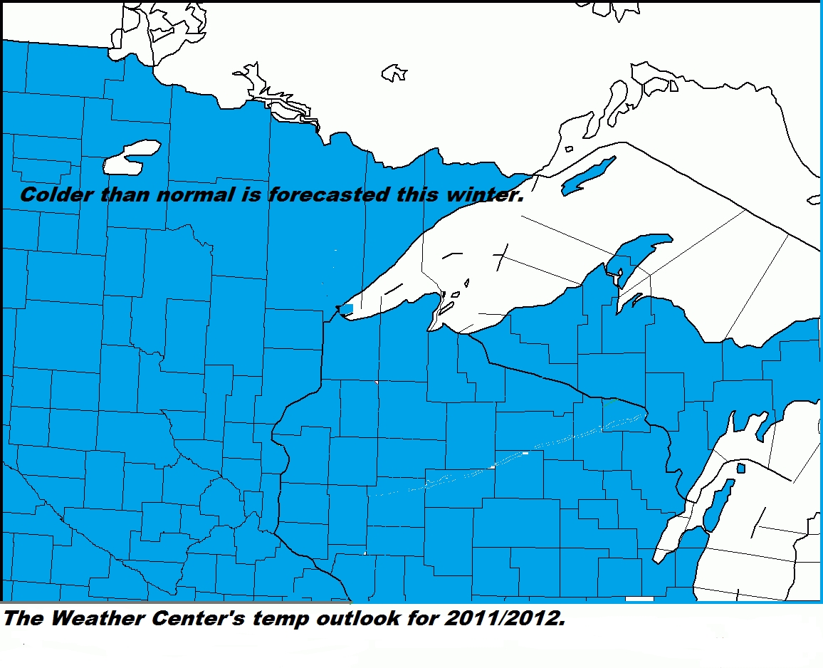
Main story here will be the cold temps…We will see temps fall to below norms through this period…There will be a chance of rain showers on the 19th and early morning hours of the 20th then a dry spell from the 20th through 23….With another shot of rain showers from the 25th through the 27th .....The the late night of the 26th and early morning hours of the 27 we could see out first snow flakes of the season….This would not come as a shock as last year we picked up a 0.25 inches of snow see picture below the long term forecast…..We will have to watch this… We will add snow mix wording into the forecast to account for this….

***LONG TERM FORECAST***

19TH … Cloudy a chance of showers. Highs 40 to 45 lows in the 30s.

20th Early morning showers,than dry highs in the 40s lows in the 30s

21st THOUGH the 24th ….Dry highs 45 to 50 lows 35 to 40.

25th … A chance of showers in the late in the day. Highs 45 to 50 lows 35 to 40.

26th. Chance of showers highs 45 to 50…. Overnight showers possibly mixing with snow lows 30 to 35

27th chance of showers possibly mix with snow in the morning hours… Highs 40 to 45 lows 30 to 35.

28th Dry highs in the 40s lows in the 30s.

Here are two pictures from last year when we had our first snowfall of the season.

Monday, October 10, 2011

Time to debunk/ Time to get the real facts out!

Where to start….Well let’s start here…I have heard and or read about how people are calling this last heat wave …. Unbelievable, unheard of, unreal and so on…. Time to debunk with the real facts!

This sure is not what I would call this!!.....In fact this is by far not that! Ok time to do some debunking…..Ok here is what I’m going to do I will list every day with the Average high and low along with the mean temps for that day, will also list the record highs and lows for that day…..This is for Rice Lake only!!! However with this last heat wave and doing some checking for other cities we found some record breaking temps however nothing we would call unbelievable, unheard of and unreal and so on…..This warm spell should not have come to a surprise to anyone, as our forecast for the fall was calling for above average temps….

OCTOBER.

1. High 63. Low 41. Mean 52… Record high/low… 87 1976/ 23 1966

2. 62 40 51 86 1976/ 14 1974

3. 62 40 51 85 1976/ 20 2003

4. 61 40 51 83 1997/ 21 1952

5. 61 39 50 78 1963/ 23 1952...Did break this had a high of 82

6. 61 39 50 81 1963/ 20 1976

7. 60 39 49 85 2007/ 20 2001

8. 60 38 49 82 2007/ 24 1976

9. 59 38 49 81 2010/ 22 2000………we did tie this today.(2011)

10. 59 38 48 80 2003/ 17 1964

11. 58 37 48 77 1955/ 21 1987

12. 58 37 48 77 1956/ 22 2006

13. 58 37 47 83 1995/ 20 1965

14. 57 36 47 81 1962/ 20 1978

15. 57 36 46 82 1968/ 20 2006

16. 56 36 46 82 1968/ 18 1952

17. 56 35 46 77 1953/ 18 1952

18. 55 35 45 85 1965/ 14 1972

19. 55 35 45 80 1965/ 11 1972

20. 54 34 44 81 1953/ 15 1952

21. 54 34 44 79 1953/ 17 1960

22. 53 34 44 73 1963/ 14 1981

23. 53 34 43 79 1963/ 13 1969

24. 52 33 43 76 1963/ 13 1981

25. 52 33 42 78 1989/ 19 1962

26. 51 33 42 78 1989/ 9 1981

27. 51 32 42 72 1989/ 9 1976

28. 50 32 41 67 1986/ 11 1967

29. 50 32 41 67 1956/ 15 1988

30. 49 31 40 70 2004/ 14 1988

31. 49 31 40 69 2008/ 13 1996

So as one can see this past heat wave was not unbelievable, unheard of, and unreal…..If we would have 90s then the those words would have fit….Sorry not this time around they don’t…..This is typical of a year when La Nina is rebuilding ….Just like last fall and more like last October….Last October we had our first snow fall on the 27th ……Last October this same time we were basking in temps in the 70s so this October is about the same as last year just a little warmer….
So don’t believe everything you read or hear, you can always count on us for the facts, not some miss guided info with a few facts that get blowing out of proration…..

Saturday, October 8, 2011

Forecast update.

Really didn't change much in the ongoing forecast.Did up temps some record highs could be possible today.Have went with sunny to partly cloudy skies per trend on the vis satellite.Will hold that through Sunday.Though we should see some more clouds begin to filter back in as we head into the late afternoon and evening. Rest of the forecast is great standing and will not reissue.
To recap.
Bumped temps up some for today and tomorrow. Removed the mostly cloudy skies and replaced it with sunny to partly cloudy skies.
Forecaster/ Paul

The forecast for Western & Northwestern WI.

Forecast concerns…. To run with PC or MC wording for today….Do we bring in shower wording to the forecast sooner than previous forecast has…How long to keep showers going….No matter what we hash out one thing is for sure, we are about to get knocked back into reality this coming work week…. Longer term looks to be cold…Still no snow is foreseen across the upper Midwest….. Time to hash all the concerns out….


***CURRENT CONDTIONS***

Map below shows the current SFC frontal boundaries and pressure systems….


At 10 AM temps are in the upper 60s to low 70s, under cloudy skies….Winds are still rather gusty out of the S/SW from 12 to 17 MPH with gusts up to 20 to 22 MPH….Dewpoint temps lower to middle 50s.

Radar is showing some showers and a few thunderstorms over MN... They are tracking towards the Northeast around 50 to 60 kts....We will have to watch this in case they do clip our far Northwestern Counties,though highly unlikely.....

***SHORT/MIDDLE TERM FORECAST DISCUSSION***

Large ridge of high pressure is centered over the Eastern states, however this still has a hold on our weather…This has kept the cold front out over MN along with showers and thunderstorms….. Looking at the 500 MB chart we find ridging out East and far West with a rather large trough throughout the Rockies into the Southwestern States…. We find a low pressure system just South of Hudson Bay Canada, and another upper level low centered over western CO….This is all evident on the water vapor imagery, and on the RCU model, Nam is rather close to with these features…GFS 00z run was a little off, however it 06z run is rather close now….Cold front is stalled out over MN and we see this frontal boundary camping over there today and tonight…In fact the cold front won’t really reach our FA until Sunday night/early Monday…Then it is forecasted to lift back North as a warm front…Meanwhile a SFC low pressure is forecasted to lift North into Northwestern MN… This is forecasted to drag another cold front into Western MN by late Sunday night into early Monday morning. This cold front shall push through the area late Monday afternoon…See no reason not to run with some rain showers….Temps really won’t take a dive until another cold front races towards and through the area by midweek….Temps are forecasted to fall back to near or slightly below normal by then…Temps may not even make it out of the 40s by Friday…..
Thought about keep temps in range of the last few days, however with the clouds around I will knock them down to the 70 to 75 range….Now if clouds thin out and we get more sunshine temps will not have a problem heading for the upper 70s to lower 80s once again, this will hold true for tomorrow as well….Have decided to pull rain chances from tonight and Sunday/Sunday night and Monday….We did talk about that in the previous forecast below.

***YOUR SHORT/MIDDLE TERM FORECAST***

TODAY THROUGH MONDAY…..Sunny to partly cloudy, highs 77 to 82 with lows ranging from 50 to 60.

MONDAY NIGHT… Slight chance of showers, lows 50 to 55.

TUESDAY/TUESDAY NIGHT…. Mostly cloudy with a slight chance of showers… Highs 60 to 70 lows 50 to 55.

WEDNESDAY/WEDNESDAY NIGHT…. Mostly cloudy with a chance of showers, maybe a thunderstorm.. Highs 65 to 70 lows 45 to 50.

THUR/THUR NIGHT… Partly cloudy… Highs 55 to 60 lows 35 to 40.

FRIDAY AND FRIDAY NIGHT…. Partly cloudy… Highs 45 to 50… Lows 30 to 35.

***LONG TERM FORECAST 15TH THROUGH THE 24TH ***

Main story in this period shall be the temps, as we will drop to well below normal for highs….There shall be off and on chances of showers throughout the period…. The 16 through the 18 and then once again on the 20th and 21st then on the 22nd…. Really hard to time shower chances this far out and long term models aren’t really agreeing…. One thing is for certain is no snow is forecasted for the upper Midwest!!..... The 540 line remains well to the North of us, the one day that is does drop into the area the moisture is already gone….

***YOUR LONG TERM FORECAST***

15TH…. Dry highs 40 to 45 lows 30 to 35

16th…. Chance of showers highs 45 to 50 lows 35 to 40

17th….. Morning showers than dry highs 40 to 45 lows 25 to 30

18th… slight chance of showers highs 40 to 45 lows 30 to 35

19th … Dry highs 45 to 50 lows 35 to 40

20th….. Slight chance of showers highs 45 to 50 lows 30 to 35

21st ….. Slight chance of showers highs 45 to 50 lows 35 to 40

22nd….. Dry highs 45 to 50 lows 35 to 40

23rd….. Chance of showers highs 45 to 50 lows 35 to 40

23th….. Dry highs 45 to 50 lows 35 to 40.

Friday, October 7, 2011

Bye bye fall colors!RIP fall 2011!!

Fall colors are for the most part gone...Strong winds today blew most of the leaves off the trees...Winds gusting up to 45 MPH this afternoon into this early evening...Had some roof damge here at the office and some small trees went down...\
Pictures below were taken this morning before the winds hit...Now there are no leaves!


Monday, October 3, 2011

The 2011/2012 winter forecast.

La Nina is back and is growing….The tropic Pacific Ocean has been cooling back off…So you ask what does this mean for the local FA? Well remember last year we had record breaking snows and record breaking cold temps…

This shall be the case once again this year….Before we get to our local area, let’s take a look at the CONUS first….

With La Nina forecasted to become stronger as we head towards winter here is out thinking…Will also based this forecast on last winter’s setup. We threw out the warm trend we are currently in as this was the same setup last year at this time….

This forecast period runs from Nov through Mar…. This is the overall outlook. This is based on the average how on the this winter will end up being once the temps and precip is averaged out…..

Ok first map is our precip outlook for the CONUS…


The map below is our temp outlook for the CONUS…


Now for the local area…. The first map is out snowfall outlook map.


The map below is out temp outlook.


We are forecasting above normal snowfall throughout much of the area,with below normal snowfall From just South of a Twin Cities MN to Durand WI line....We are forecasting a colder winter throughout the whole area.....Once again this is how the winter is forecasted to average out....

The forecast for Western & Northwestern WI

Nice warm dry forecast…Temps should be above normal for this time of year, with dry conditions….This will lead to a fire danger…. Next chance of showers comes in for the weekend,looks slim as or right now…..

The mild and dry conditions will camp out over the FA this week and next week. Does look like a weather pattern chance is in store for the end of the long term forecast.

***CURRENT CONDITIONS***

At 7 AM temps range from the middle 30s North to the middle 40s South and West….Skies are clear with light to calm winds….Some fog being reported at a few stations.

***SHORT AND MIDDLE TERM FORECAST DISCUSSION***

Sure is not much to talk about in this period… Large ridge of high pressure will camp out over the area this week…. This will allow for dry and mild conditions to preside through week….Upper level ridge is forecasted to push off to the Southeast of the FA this weekend, this will allow for a weak system to move into the FA for this weekend….Will have a slight chance of showers for Sat night through Monday…. Still may pull this out of the FA,unless we can get better moisture flow back into the area. With the dry conditions forecasted fire danger will be on the increase….Winds don’t appear to be a problem, which will be a good thing….

***YOUR SHORT/MIDDLE TERM FORECAST***

TODAY and TONIGHT.... Sunny highs 70 to 75,Clear tonight with lows 40 to 45.

TUESDAY and TUESDAY NIGHT..... Sunny highs 70 to 75. Lows 45 to 50 under clear skies.

WEDNESDAY and WEDNESDAY NIGHT..... Sunny highs 70 to 75…. Lows 45 to 50 under clear skies.

THURSDAY and THURSDAY NIGHT.... Mostly sunny highs 70 to 75…Lows 50 to 55 with clear skies.

FRIDAY and FRIDAY NIGHT.... PC highs 70 to 75… Lows 53 to 58.

SATURDAY…. Mostly sunny, highs 70 to 75..

SATURDAY NIGHT… PC a slight chance of showers, lows 50 to 55.

SUNDAY and SUNDAY NIGHT..... PC with a slight chance of showers, highs 65 to 70…Lows 50 to 55.

MONDAY.... PC slight chance of showers, highs 65 to 70.

***LONG TERM FORECAST DISCUSSION***

Once again not much to talk about here…. Once the weak system clears the area Monday, a large area of high pressure is forecasted to move back overhead setting the stages for another dry and mild period… There are singles in the long term models that a pattern chance is on its way for the end of this cycle. A strong cold front is forecasted to move into and through the area on the 16th/17th time frame.This is forecasted to draw colder air back into the FA… The 540 line sets up well to our West/Northwest so no snow is forecasted!!.

***YOUR LONG TERM FORECAST***

TUESDAY 11TH THROUGH SUNDAY THE 16TH …..Dry and mild highs will range from 65 to 75, with lows ranging from 45 to 60…..

MONDAY 17th … Chance of showers highs 50 to 55 lows 35 to 40.

TUESDAY 18th … Chance of showers highs 45 to 50 lows 35 to 40.

WEDNESDAY 19th... Chance of showers highs 45 to 40 lows 35 to 40.

Saturday, October 1, 2011

Looking back at September

Looking back at September… We had 4 thunderstorm days we had no severe thunderstorm days. No watches or warnings were issued for the month of September.


Days that had thunderstorms are as follows.

September 1st

September 2nd

September 3rd

September 21st

September was a rather wet month mainly the last 2 weeks as a cutoff upper level low kept moisture flowing into the area.

The morning hours of September 15th many areas saw the growing season come to an end. There was even a trace of snow throughout the Central and Northern areas….

September was slightly cooler than normal, again that was mainly do to the upper level cutoff low that kept clouds and showers going for about 2 weeks.

Looking back at last September 2010

Last year we had 5 thunderstorms days. 4 non severe thunderstorm days…1 severe thunderstorm day.

So we lost 1 thunderstorm day in September 2011.

Our winter forecast may be issued next week… Some may love it, well many will hate it!

Slighty past peak now.

A lot of fall colors leaves did blow off the trees the other day....Still not bad though lots of color to be found...Get out and enjoy them as we are going slightly past peak now...