Wednesday, August 31, 2011

The Forecast for Western & Northwestern WI.

Forecast problems really none… Will be going into a drier weather pattern starting Sunday and last right through much of the long term forecast….


***CURRENT CONDITIONS***

At 9 PM…. Temps in the upper 60s to lower 70s…. Upper 50s around Lake Superior… Skies are cloudy dp temps in the middle 60s to lower 70s…. Fog is being reported in Superior… Wind are light from the E/SE… NE off the Lake in Superior.

***SHORT TERM & MIDDLE TERM FORECAST DISCUSSION***

Warm front has remained South of the FA, however low level moisture that has been over running the front has caused clouds to remain locked in over the FA today….Same is hold true for tonight….Warm front is found over the Twin Cities area and then ridding South along the MS river valley. We find a cold front reach South from Northern Canada into Eastern MT to a 998 MB low pressure system over Southeastern MT… Warm front is forecasted to lift Northwards however looks like it will be washing out….Meantime the low over SE MT is forecasted to move into Central ND… The cold front is forecasted to be from Central ND through Central SD down into the Northwestern part of NE by 12z…1020 MB high pressure will be found over far western NC this along with the low to our West will draw in warmer air and higher dewpoints into the FA… With all the media hype about 90s for tomorrow….1. winds will not be from the Southwest, where we would get the higher temps…. Also clouds if they don’t clear soon enough or hold all day like today, this will hold temps down…. I will not buy into 90s I will run with 80 to 85 temps in tomorrow’s forecast to allow for morning clouds…Cold front by 18z should be on Western MN’s door step, by late Thursday night early Friday 00z the cold front should be in Central MN then it is forecasted to clear my FA by 12z Friday….. Showers and thunderstorms will be likely Thursday night into early Friday morning… Some thunderstorms could become severe, with large hail and damaging winds being the main threat…This looks to take place in my Central and Northern areas…My Southern areas look to remain capped, however once the front pushes though those area can except post frontal showers with a clap of thunder or two.Saturday we see another system making a beeline towards the FA… Not to thrill on precip chances right now…. This system will however drag a strong cold front into and through the FA….In fact on Sunday it won’t feel like the last weekend of summer it will feel like Halloween with highs in the middle 50s to maybe 60….

There will be a slight chance at frost in our colder spots Sunday night…. Mainly Northern Barron, Polk, Rusk Counties and points North….The closer one gets to Lake Superior the less of a chance of frost….

This will also start a very long dry spell for the FA right though much of the longer term forecast….

*** YOUR SHORT & MIDDLE TERM FORECAST***

Rest of tonight… Cloudy some fog possible with drizzle lows 60 to 65 winds calm to light.

Thursday… Morning clouds than becoming PC highs 80 to 85 winds South/Southeast 10 to 20 MOH with gusts up to 30 MPH.

Thursday Night…. Showers and thunderstorms likely, some thunderstorms could become severe late, mainly over my Central and Northern areas…. Lows 65 to 70.

Friday… Morning showers than clearing, cooler highs 65 to 70. Lows 40 to 45.

Saturday… Slight chance of a shower or thunderstorm, highs 65 to 70. Lows 40 to 45.

Sunday... PC cooler highs 55 to 60.

Sunday Night... clear and cold lows 35 to 40, some frost possible see above dis.

Monday through Wednesday…. Dry highs 65 to 70 lows 40 to 45 Monday night than warming to 45 to 50…

***LONG TERM FORECAST DISCUSSION***

Not much to talk about here as we will keep the dry spell from the middle term going right through the 15th…. Will be a slight chance of rain on the 16th….. Other than that look for temps to run from 70 to 75 for highs while lows start off in the 45 to 50 degree range than 50 to 55 degree range…..

***CONFINDENCE LEVEL****

High in the short term to middle term on temps and precip….

Low on temps in longer term as we might be to warm….

Mod on precip in the longer term…..


Sunday, August 28, 2011

Tropical Storm Irene.

Tropical storm Irene still pounding the Eastern Coast line..


Flooding rains heading North of New York City…..Major flooding has been occurring in the Northeast overnight.

The main player was and still is the major flooding….There was also damaging winds and a few tornadoes were reported overnight….Major beach erosion up and down the Eastern Coast line…Major inland flooding still happen as heavy rain keeps pounding the Northeastern States… Coast line areas for the most part seems to done with the major flooding storm surge is now over….Most concerns are now focused inland with the major flooding….Many roads are impassable….Many rivers will be cresting within the next 24 hours…..

Good news with hurricane Irene the storm surge and high tide really didn’t join forces …..

Main concerns now shift to MA Up State NY, VT,NH….. These areas should see major flooding throughout the day.Still should see Coastal flooding in these area also...

We are still trying to figure out if the storm made landfall in NY as a hurricane or a tropical storm….As of right now Irene is a Tropical storm…..

The last update we got from the NHC as of 8:00 AM EDT.

Irene was a Cat 1 hurricane….(this is now a Tropical storm)

The center was 40 Miles South/Southwest of NYC…( has made landfall)

Pressure was 963 MB…

Drier air has worked its way into the Southern areas of Tropical storm Irene…The heavy rain should be ending in NYC soon…

Heavy rain will keep pounding areas North of NYC/Long Island…..

Tropical Storm Irene is still a dangerous storms…There will be strong winds with trees getting blown down along with more power outages….Main threat will be the major flooding…..

2 million people still without power….However power is slowly being restored….

At least 10 related deaths….

This will be the last update from The Weather Center……

Here are some radar grabs mainly from last night…


Here is the latest satellite imagery.


Saturday, August 27, 2011

Hurricane update number 2.

The Weather Center is the only blog in the area to be covering hurricane Irene!!

Irene is now back over water per radar and satellite imagery…Irene is still moving North/Northeast…
The latest in Irene as of 8:00 PM

Hurricane Irene is located about 100 Miles South/Southwest of Ocean City Maryland
Sustained winds are 80 MPH
Irene is slowly moving North/Northeast at about 16 MPH…
Pressure reading is at 951 MB…

Irene may not be that strong of a hurricane, however this storm is big… Hurricane winds extend outwards up to 85 miles from the center….Also Tropical winds extend outward up to 290 miles…. So far there have been 9 related deaths that we are aware of from hurricane Irene.

9 related deaths to do hurricane Irene… 4 in NC, 3 in VA, 2 in FL.

2 million people without power throughout the Eastern Coast line.

So far 1 million people have been told to evacuate….300,000 we told to evacuate in NYC….Most of NYC has been shut down as of noon today.

VA and MD now getting pounded by hurricane Irene….Airports in MD have been shut down.

Mandatory evacuations for parts of VA,MD,DE,PA,NJ, and NY…..

The biggest threat from hurricane Irene will be major flooding from the storm surge and high tides, along with 10 to 14 inches of rain…..Even inland areas will see major flooding as heavy rainfall occurs….Some areas could see 6 to 12 inches of rain... We will also see damaging winds and some tornadoes will be possible.....

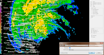
Below are radar grabs we have been getting throughout the day….Many more will come…We used our GRLEVEL2 radar as we can see the finer details compared to GRLEVEL 3 radar……


Some sat images....


Hurrican Irene...The only blog in the area covering it!

The Weather Center is the only blog in the area to be covering hurricane Irene!!
Why are we covering this hurricane...Well close to 1000 veiwers have emailed us asking what is going on...Some may not be able to keep up with the news or what not...So with that many people asking and wondering about their friends and family along the Eastern Coast we have decided to bring you info off and on....For the latest watch TWC or a major news network as we won't be here every second....

The latest in Irene as of 4:00 PM
Hurricane Irene is located about 50 Miles South/Southwest of Norfolk VA.
Sustained winds are 80 MPH
Irene is slowly moving North/Northeast at about 13 MPH…
Pressure reading is at 950 MB…

Irene may not be that strong of a hurricane, however this storm is big… Hurricane winds extend outwards up to 85 miles from the center….Also Tropical winds extend outward up to 290 miles…. So far there has been 3 related deaths that we are aware of from hurricane Irene, this number will surely end up going up.….Many people are without power ..There has been major flooding…. This will be the story as Irene makes its way toward the New England states, by then Irene should weaken more and it should become an post tropical storm system…
Onece again this may not be that strong of a storm, however it is one of the most danagerous ones...For reasons stated above...People in the path of this Hurricane should move to higher ground now....The flooding is going to be and has been. a real problem with high tides and tons of rainfall....

Below are radar grabs we have been getting throughout the day….Many more will come…We used our GRLEVEL2 radar as we can see the finer details compared to GRLEVEL 3 radar……


Friday, August 26, 2011

The forecast for Western & Northwestern WI.

The chance of showers and thunderstorms for today, how far south into the FA to place them….. Temps will be a roller coaster ride throughout the short/middle/and long term periods. Did warm temps up in the longer periods, though not confident in this….


***CURRNET CONDITIONS***

At 9 AM skies range from cloudy to partly cloudy throughout the FA…Temps in the middle 60s to the lower 70s. DP temps in the lower 60s…Winds South/Southwest 6 to 8 MPH with a few higher gusts…

***SHORT/MIDDLE TERM FORECAST DISCUSSION***

Radar is showing an area of showers and thunderstorms over my far Northeastern areas this morning extending down into Rusk County….This area has been driven mainly by an area of forcing way ahead of the cold front, which is now in Northwestern MN…Cold front should enter the FA around 18z and then clear the area around 22z per DLH WRF model…Not a lot of moisture for this front to work with, instabilities are not that great either….Overall dynamics just aren’t there…Nevertheless there is a little forcing and there shall be some lift along the cold front and boundaries left over from this morning convection…With that said will run with a small chance of showers and thunderstorms through the afternoon mainly in my Northern to Central areas… Shower and storm chances in my Southern areas not looking good at all with the thunderstorms in IA ….

Have up temps for today a little will run with 78 to 83…..Tonight high pressure takes over this will allow for a chilly night across the FA with some middle 40s North to 50s Central and South…. Saturday will be a great day under sunny skies with highs in the lower to middle 70s…Sunday another trough/cold front is forecasted to push into the area once again there will be a chance of showers and a few thunderstorms right through Sunday night….Thought about dropping rain chances from the forecast as the same setup seems to be in place though this system is somewhat weaker….Next chance of showers and storms looks to be in the Wednesday through Thursday time frame…. Temps will be cooler for much of the upcoming work week….Highs in the lower to middle 70s through mid week… Lows in the 50s…..Slightly warmer temps forecasted by week’s end.

***YOUR SHORT/MIDDLE TERM FORECAST***

TODAY…. Partly cloudy a few showers and thunderstorms, highs 78 to 83… Winds South/Southwest becoming 10 to 15 MPH. west/Northwest this afternoon.

TONIGHT… Partly cloudy cool lows 48 to 50. Winds North/Northwest 5 to 10 MPH becoming calm.

SUNDAY & SUNDAY NIGHT…. Slight chance of showers and thunderstorms, highs 68 to 73. Lows 48 to 50.

MONDAY & MONDAY NIGHT… Partly cloudy, highs 70 to 75, lows 50 to 55.

WEDNESDAY THOUGH THURSDAY…. Slight chance of showers and thunderstorms… Highs in the middle to upper 70s with lows in the middle to upper 50s.

*** LONG TERM FORECAST DICSUSSION SEP 2 THROUGH SEP 11***

About the only thing I did here was to up temps, not really confident in doing that but the last two model runs did show warmer temps than we had in our other forecast…. Thinking is we may end up dropping them back off once again…..

There will still be a chance of showers and thunderstorms throughout the this period, really hard to time things this far out in time…

Confidence level in precip moderate, confidence level in temps low.

***YOUR LONG RANGE FORECAST SEP 2 THROUGH SEP 11***

2ND … Showers and thunderstorm possible, highs 75 to 80.Lows 50 to 55.

3rd …. Showers and thunderstorms possible, highs 70 to 75. Lows 45 to 50.

4th… Showers and thunderstorms early than dry… Highs 65 to 70 lows 45 to 50.

5th… Dry highs 65 to 70 lows 50 to 55.

6th… A slight chance of showers highs 70 to 75 lows 60 to 65.

7th…. Dry highs 75 to 80 lows 60 to 65.

8th & 9th… Showers and thunderstorms highs 70 to 75 lows 55 to 60.

10th & 11th…. Dry highs 60 to 65 lows 45 to 40.


Thursday, August 25, 2011

Leaves are slowly changing.

As one can see around the area leaves are slowly getting some colors to them, most tress now have a lighter green to a light yellowish to them,no longer that dark green..... Picture below shows this rather well, also some tress getting some orange  to them....Fall colors now getting underway in the area.Over the week or so there should be more tress showing colors...
Click on picture to see a bigger size.

Tuesday, August 23, 2011

Strong thunderstorms pounded parts of the area throughout much of the day.


Strong thunderstorms moved throughout much of the Central and Northern areas this morning and into the afternoon…. The areas that seem to have got hit the hardest were as follows.Northern/Central Barron County, Central and Southern Washburn and Sawyer Counties, along with parts of Burnett County….Rusk County was a also affected….Chippewa County also had some hail.

Heavy rainfall and very gusty to strong winds have occurred in these areas….There were some small trees downed along with a few branches…Though the storms were not severe, they did pack one good punch…The same areas got hit multiple times…… A short wave decided to camp out over Duluth both at the SFC and 500 MB level for most of the today… This has caused rounds of strong thunderstorms to effect said Counties above… See both Vis satellite and Water vapor satellite….As this feature shows up rather well…..Remind you the clod front has not pushed through the area yet and is forecasted to do later tonight….Though thunderstorm chances are null now….

Below is the both satellites images showing the short wave….


Next two images are the radar grabs showing where the strong storms have setup.Only radar grabs I got before I lost my Internet.


Here are the afternoon pictures of all the rounds of storms that pounded the area with gusty to strong winds,some small hail, and heavy rainfall amounts….Total rainfall here at the office was 1.91 inches from both morning and afternoon storms…..


Click on images to see a bigger size.


This morning storm pictures

As forecast strong thunderstorms moved through the area, however none were severe,still had heavy rainfall, and very gusts to even strong winds....