Monday, July 25, 2011

July 19th severe weather write up part one.

A very special thanks to Todd K. From the NWS for letting me show him the areas of damage that I knew about...I sure did learn more from that storm assessment!Was a fun afternoon more on that later.
Though I was not chasing this storm per say. I have some of the same info on here as I do in part two…..

Here is my chase log….

So why did I decided to chase in Douglas and Washburn Counties? Well the warm was just North of Barron County. Was like in Central Washburn County over into Northern Burnett County. Plus there were outflow boundaries from all the morning storms laying around…..So decided I would chase a few strong cells that morning…. By mid afternoon radar was showing strong/severe thunderstorms in North Central/Northeast MN…. So I decided to head to Oliver and play them storms… Once there I was looking at the radar data and SFC OBS wondering if Lake Superior would kill these storms…Thought about heading in MN Southwest of Duluth, however the gut was telling to stay in WI but head more South than were I was at….So I ran with that plan…. To make a long story short it was the best move of the day….Got on different lines of storms….With each passing line the warm front was pushed South a little more. I kept moving South with the warm front….I did notice a storm that blew up in Burnett County… I really was not paying much attention to this storm when it was in Burnett County, I knew there was a tornado warning on it, however the storm I was on had a tornado warning on it..So I decided to stay where I was at…Had to get lightning video, and waited to see if the possible tornado would pass just to my North….To say the least if there would have been a tornado it would have been wrapped in rain by time it got to the area I was sitting at….Decided to make a play on the cell in Polk County….. I did get on it but it was too late by then so I called that chase off before it really started. I more les went and say hello and goodbye to the storm. Was a very long, but fun day of chasing…

The day afterwards.
The morning of the 20th I went back and looked at the radar on this cell and downloaded the data…I have the loops of the Reflectivity and the Radial Velocity below … I also have stills will post them if needed…I used level 2 data has it is more detailed than level 3….I decided to run with a time from 7:00 PM through 8:10 PM, as this shows the rotation moving through Northeastern Polk County into Western Barron County….See the Radial Velocity loop for that…

First off I would like to say l thanks to a friend of mine, Derek from NW Wisconsin Weather(blog) for tagging along on the 20th and showing me his area of Clayton and areas to the Southwest/South/Southeast of Turtle Lake… Though we saw some damage I saw nothing that would indicate tornado damage in those areas, as I was heading to Derek’s place I did see some damage along HWY 63, nothing to indicate tornado damage wasn’t a lot of damage… When we were South of Turtle Lake didn’t really see much damage I decided it was time to get on HWY T in Polk County and head for the Pipe Lake area….When we got to the corner of HWY T and 190th large trees downed in a yard …. We also found a place on HWY G that had large tress down and a garage damaged, some of the corn in this areas was damaged…We headed for the Pipe Lake area… We did find damage along the Southeast side and East side of the lake that had damage, this damage did look like tornado damage….We ended up driving around the lake and came upon more damage along Pipe Lake road and Pipe Lake Lane…. This area was really hard to tell what many have happened here….Many large tress blown downed/snapped off…Power lines were downed…Some cabins/homes had tress fall onto their roofs…The few people I was able to talk to said they were not home at the time of the event…(which may have been a very good thing) I called the NWS was able to talk to Todd and they did have a survey planed for the 21st I sent the pictures I took to them guys when I got back home later that evening.

The morning of the 21st.
 I gave Todd a call to see if he was still heading up, he was….Long story short we met in Turtle Lake and we headed out on HWY T towards the damage areas….I took Todd to the areas that Derek and I saw the day before…Then we also checked others areas. I will have the link to the NWS write up down below…(as of the time of this writing the NWS writ up on this storm has not been posted so keep checking back on their site).

Ok time for some strange and yet funny things….For those who know me know the strangest and funniest things happen to me… Well of course yesterday would prove that once again not only once but twice….. Without getting into all the details on the first one…..Let’s just say the very first place we stopped at, well I have never seen what we saw… Though the person was interesting to listen to it was hard not to laugh, but I didn’t…..Well we left that area, went up the road a little, well then I thought I heard a bear or something…Didn’t sound right….Well finally we heard the chainsaw running thank God for that….Well Todd and I were talking he said something and that mental image stuck in my head the rest of the day..(Not one I wanted either lol )…Well the second funny part was at the end of the day I decided it was time to go home, we were talking and Todd said something like maybe I should turn around…Then it hit me I was going to be heading home with Todd in the truck, yeah I felt like a heal on that one….I’m sure this damage survey will be talked about a lot at the NWS, after that I’m thinking them guys will never want to come back to WI, well least not have me around lol……Only in WI and only to me……I just had to share that with everyone…..

Ok back to the matter at hand…

I will not disclose the information on what we found or what the NWS thinks, Not until they post it on their site.

Here are some damage pictures taken on the 20th and 21st …..


Below is the Reflectivity loop showing the supercellular storm plowing across Northeast Polk County and Western Barron County.


Below is the Radial Velocity loop Showing the rotation moving across Northeast Polk County and into Western Barron County.

You will have to click on the two images above to get the loop to play...
Without reposting all the info here is the link to the NWS write up, along with the setup for the severe weather threat for the 19th ..
http://www.crh.noaa.gov/news/display_cmsstory.php?wfo=mpx&storyid=71082&source=2
Here are some pictures of the storm and flooding rain...All taken in Barron County.


Friday, July 22, 2011

Part two severe weather write up.

Tuesday started off as any other chase day…Checking the computer models and SFC OBS along with everything else…Had two choices…1 I could sit home and wait for the storms to come to me or two head North….Well I decided to head North….I know I said I would never chase up North again, however I had to give it a try…..So after playing around with some morning non severe cells, it was time to book to just Southwest of Oliver, WI. Looking at the radar I figured ok I need to drop a little more South so I did…. Well sitting there I was trying to figure out if I Should stay or head into MN to make a long story short I stayed…Was a great play on my part first batch of severe storms rolled through, so did the fog so no pictures of those storms….Then the next batch of storms took off these looked to heading Central and Southern Douglas/Northern Washburn Counties…..So South I headed…Not too much to write home about those storms….What was next in line for was……I did get a little break in the action from 20:27 through 21:54 than again from 22:20 to about 23:00..After 23:00 that’s when the main show took place in from Just South of Wascott to Just North of Trego… That storm produce winds that I recorded of 59 MPH it took out many tress along HWY 53…I’m sure there was damage to the East also…Come to find out later there was…Northeast Barron/Southwestern Sawyer Southeastern Washburn, and Northwestern Rusk Counties got hit with some very large hail and areas of damaging winds.

A fast view of the setup….
A warn front was Just North of Barron County…Mainly was setup through Central Burnett, Washburn, and Sawyer Counties…Wind shear and instabilities were really great along and North of the front, really is was good in most areas…Thunderstorms blew up over in MN and rode down along the warm front and instability/wind shear axis… With each way of severe thunderstorms this helped slowly push the frontal boundary South throughout the day…So this was the best choice was to play along the warm front…. I ended up running along HWY 53 known that there were some areas good enough to view the storms…After that line of storms pushed East Southeast I waited for the next batch of storms…Those were the ones I got the lightning video of…. After I got done playing with shelf’s , hail, blinding rains I thought why not try to get that cell in Northeastern Polk County… Headed for caught it, but by this time it was slowly weaken, plus daylight was fading fast…Called the chase off then…. I had enough for one day anyway…..

Below are a few pictures of the storm that caused the most damage… Won’t really post to many cause the video shows most of what I took as stills.


Below are a few damage pictures I was able to get along HWY 53.


Below is the Reflectivity loop using level 2 data as it shows the finer details.You will have to click on the radar to get the loop to play...


Below is the Radial Velocity loop, once again using level 2 data…. Level 3 data is good for out in the field won’t eat up bandwidth as level does learned that the hard way.


Wednesday, July 20, 2011

Douglas County severe thunderstorm and lightning video

What a very long chase day I covered many Counties...Barron,small part of Burnett,Douglas,Polk and Washubrn Counties...From what I saw with damage the hardest hit area was Just South of Wascott to a few miles North of Trego...Other damage was in Barron County Southwest side to Central and parts of Northern Barron County had damage also...Burnett County I did really see much damage there...Polk County there was a few areas of damage...Looks to be a busy day for me tomorrow....
http://www.youtube.com/watch?v=6Dk5XbGuwUc
Here is part one of the lighnting video..
http://www.youtube.com/watch?v=D0RY0ysqGh8&feature=mfu_in_order&list=UL
A very detailed and long write up will be done once I go through all the damage tomorrow.Lots of Counties to cover!..Will post a few pictures,however most of them are on my FB page....

Monday, July 18, 2011

Todays mini chase

Well today was a fun little chase Chased from Eastern Barron County into Rusk County before the storm went poof...Pictures below is what it looked like on Radar...Yeah I had to use the crappy GR3..GR2 is better more details but o well....


Pictures below is what I was looking at on the way to the storm!....


Pictures below are from last nights chase these were in Sawyer County..I have many more just haven't got to them yet....


Like always click to see a bigger size.

Heat index temps.

Here is a a list of how high the heat index was yesterday and so far today... All this info comes from the NWS  the Twin Cities,We did mark the Counties in bold red and the highest reading in read.
...BARRON COUNTY...

1 SSW CHETEK (1050 FT)(WIDOT) 224 PM JUL 17 103 F
2 WNW CAMERON (1105 FT)(OTHER-MTR) 435 PM JUL 17 105 F
RICE LAKE (1167 FT)(AWS) 304 PM JUL 17 112 F
1 SW CUMBERLAND (1227 FT)(AWS) 144 PM JUL 17 115 F
..CHIPPEWA COUNTY...

EAU CLAIRE ASOS (905 FT)(ASOS) 356 PM JUL 17 112 F
1 SSE STANLEY (1070 FT)(WIDOT) 511 PM JUL 17 113 F
...DUNN COUNTY...

2 E MENOMONIE (895 FT)(OTHER-MTR) 155 PM JUL 17 108 F
3 SW KNAPP (1210 FT)(WIDOT) 510 PM JUL 17 111 F
...EAU CLAIRE COUNTY...
2 NE EAU CLAIRE (898 FT)(AWS) 414 PM JUL 17 115 F
1 NW AUGUSTA (970 FT)(RAWS) 305 PM JUL 17 116 F
...PIERCE COUNTY...
1 W BAY CITY (784 FT)(OTHER-MTR) 415 PM JUL 17 110 F
1 SW RIVER FALLS (897 FT)(AWS) 434 PM JUL 17 116 F
...POLK COUNTY...
2 NNW BALSAM LAKE (1185 FT)(AWS) 812 AM JUL 18 89 F
1 NNE FREDERIC (1273 FT)(APRSWXNET) 820 AM JUL 18 93 F
1 SSE OSCEOLA (902 FT)(OTHER-MTR) 215 PM JUL 17 111 F
1 NNE OSCEOLA (764 FT)(AWS) 424 PM JUL 17 112 F
2 ESE SAINT CROIX FALLS (1190 FT)(WIDOT) 218 PM JUL 17 112 F
...RUSK COUNTY...
5 ENE LADYSMITH (1236 FT)(OTHER-MTR) 355 PM JUL 17 111 F
2 E BRUCE (1090 FT)(WIDOT) 326 PM JUL 17 113 F
6 NNE BRUCE (1003 FT)(APRSWXNET) 333 PM JUL 17 113 F
2 SW LADYSMITH (1147 FT)(RAWS) 505 PM JUL 17 117 F
...ST. CROIX COUNTY...
1 N BALDWIN (1138 FT)(APRSWXNET) 212 PM JUL 17 103 F
2 N NEW RICHMOND (997 FT)(OTHER-MTR) 415 PM JUL 17 105 F
NEW RICHMOND (950 FT)(AWS) 429 PM JUL 17 105 F
5 SE BALDWIN (1150 FT)(AWS) 220 PM JUL 17 107 F
5 WNW GLENWOOD CITY (1147 FT)(APRSWXNET) 340 PM JUL 17 115 F

Friday, July 15, 2011

The forecast for Western/Northwestern WI.

Have not really changed much in the forecast…..Main concern will be the long lasting heat wave that we have been talking about over the several days…. The severe weather threat still looks to be null for today best chances of that will be over in MN…Don’t like the heat that we will be in for, you will love the long range forecast!


*** CURRENT CONDITIONS***

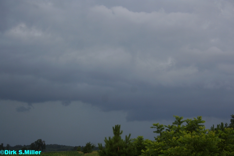
As of 10 AM all stations are reporting Cloudy skies with showers….Temps in the upper 60s to lower 70s…Dewpoints are in the middle to upper 60s…So some fog in areas….Here at the office a thunderstorm with 71° dewpoint of 63.1°Winds Southeast at 5.7 MPH

***SHORT TERM/MIDDLE TERM FORECAST DISCUSSION***

The main player in this forecast cycle will be the long lasting heat wave…Warm front with a short-wave moving into the area is sparking off showers and thunderstorms this morning…Not thinking any severe thunderstorms for today with all the clouds around and this morning’s showers and storms….Some of the showers and storms could produce rainfall amounts around an ½ inch..Will keep showers and thunderstorms going through tonight as the warm front works North/Northeast…Once again thinking the severe weather threat is going to be null for today and tonight in the FA best chances for severe storms would be over in MN, and we have already been seeing this all morning long…Still heavy rain could be a problem….Saturday morning showers and storms should clear the FA, setting the stage for a warm and humid day….Heat ridge will be in place for the remainder of the short and middle term forecast….This will set the stage for hot and humid conditions throughout much of next week… Heat indexes are forecasted to range from 100 to 110…I wouldn’t be shocked to see a day or two with heat indexes up to 115….As far as the temps go have decided to stay the same track so will run with lower to middle 90s may be a day we see upper 90s the 700 MB temps won’t be as warm as that happened back in June… So as of now don’t foresee any 100s…. Some banks may flash 100 though but who cares about them.There will be chances of showers and thunderstorms mainly during the overnight and early morning hours on Sunday and Monday…. Strong cold front is forecasted to work its way into the area Thursday’s time frame….Will still be rather warm and humid but relief is on its way!

***NOW YOUR SHORT TERM/MIDDLE TERM FORECAST***

TODAY… Mostly cloudy with showers and thunderstorms this morning then again later this afternoon. No severe thunderstorms are forecasted…. Winds South/Southeast 5 to 10 MPH..Highs 75 to 80.

TONIGHT… Mostly cloudy with showers and thunderstorms. Winds South/Southeast 5 to 10 MPH.Lows 65 to 70

SATURDAY…. Showers and thunderstorms in the morning than becoming partly cloudy.. Warm and humid. Highs 84 to 88…South/Southwest winds 5 to 10 MPH

SUNDAY/SUNDAY NIGHT… PC with a chance of late evening and overnight showers and thunderstorms. Hot and Humid highs 90 to 95. Lows 70 to 75.

MONDAY…. A chance of morning showers and thunderstorms, otherwise mostly sunny, hot and humid highs 90 to 95.

MONDAY NIGHT… Partly cloudy, warm and humid lows 70 to 75

TUESDAY/TUESDAY NIGHT … Mostly sunny hot and humid highs 90 to 95 lows 70 to 75

WEDNESDAY…. Partly cloudy Hot and humid highs 90 to 95.

WEDNESDAY NIGHT… Warm and humid…a chance of showers and thunderstorms lows 65 to 70

THURSDAY…. Partly cloudy a chance of showers and thunderstorms warm and humid highs 84 to 88.

***LONG TERM FORECAST DISCUSSION(MONDAY JULY 22TH THROUGH WED JULY 30th ***

Don’t like the heat and muggy air, this forecast is for you then!....Yes it will be getting cooler no more 90s to be found right through this period….There will be chances of off and on showers and thunderstorms with waves and frontal boundaries, timing out this far it to hard.

***NOW YOUR LONG TERM FORECAST***

JULY 22nd … Morning showers/storms than Dry cooler highs 75 to 80.Lows 60 to 65

JULY 23th… Dry highs 70 to 75 lows 55 to 60

JULY 24th…. A chance of morning showers and storms. Highs 70 to 75 lows 55 to 60

JULY 25th … Dry highs 75 to 80 lows 55 to 60

JULY 26th ... Dry than a chance of late night storms highs 75 to 80 lows 60 to 65

JULY 27th …. Morning showers/storms than late afternoon showers/storms…Highs 80 to 85 lows 60 to 65

JULY 28th …. A chance of showers and storms…Highs 75 to 80 lows 55 to 60

JULY 29th and 30th.. Dry highs 75 to 80 lows 55 to 60

StormPath update

Updated StormPath.....

StormPath forecast

We are watching a line of strong to severe thunderstorm in MN....The Weather Center's StormPath is showing us one area that could effect the area if the storms hold their own...See image below,click on image to see bigger size. Some weaken has happened over the last few radar scans....

Thursday, July 14, 2011

New product

We here at The Weather Center are very happy to bring you a new product....Called Storm PathTracker...
This will allow us to show our viewers a radar  grab with the storm path and cities that may be effected by the storms along with the ETA of storms...Click on image to see the sample for yourelf!!!

Radar est. rainfall amounts

Radar est rainfall amounts from 3:14 PM yesterday through 11:23 PM today....As you can see most of the heavier rain fell North of HWY 8....Mainly through Central and Northern Barron County over int to Ruck County...Over an 1/2 of rain has fallen from Just of Rice Lake East and Slightly Southeast of there Towards Bruce and Ladysmith.....Bruce picked up 1.10 inches of rain....Most of the rainfall happened during the overnight hours.....Here at the office we picked up 0.38per radar the gauge is reading 0.49.Click on image for bigger size.

Wednesday, July 13, 2011

Some office facts

I have not decided how I'm going to do this just yet if I will post one thing per night or a few things....We will be posting some of the programs we use here at The Weather Center to help us make our forecast,and our short term forecast.....Now not the way we post this info is not saying its the order we use or run them...
The one in the picture is our AWIPS program we use...This is good for short term forecasting....Picture below.
We can look at three things at once could use 4 but 3 works better...Above we are looking at SFC OBS,Satellite, and radar....We can overlays computer model data on the planes along with other info.

Tuesday, July 12, 2011

Wisconsin tornado county/Barron County severe weather count.

Wisconsin tornado count so far in 2011 is up to 31 so far. We will break this down evening more….


EFO tornadoes = 8

EF1 tornadoes = 16

EF2 tornadoes = 6

EF3 tornadoes = 1

EF4 and EF5 tornadoes = 0

The NWS reports that tornadoes happened only on 6 days so far this year…

April 10th

May 22nd

June 8th

June 19th

June 21st

July 1st

The counties in Wisconsin that have see tornadoes thus far this year are as follows.

Adams, Barron, Brown, Calumet, Dane, Dodge, Douglas, Eau Claire, Florence, Fond du Lac, Forest, Green Lake, Juneau, Langlade, Lincoln, Outagamie, Price, Waushara, Waupaca, and wood.

The average yearly tornado for the period from 1981 through 2010 is 23 tornadoes….So we are above average by 8 tornadoes so far this year.

***NOTE***
The above information is preliminary….

Here is the monthly break downs of the average tornadoes per month. This is the official average from 1981 through 2010.

Jan 0.1

Feb 0.0

Mar 0.2

April 1.2

May 3.4

Jun 7.5

July 5.6

Aug 3.1

Sep 1.8

Oct 0.3

Nov 0.1

Dec 0.0

Total 23.1 tornadoes….

All the above information comes from the NWS….

The information below comes from The Weather Center.

From Jan through July 12 we have had 5 severe thunderstorms days…. Severe thunderstorm days are classified as follows….1 we have recorded a wind speed > than 58 MPH…2 Saw hail > than 1 inch. 2 Saw a tornado.3 saw wind damage from thunderstorms…. We also used spotters/chasers reports from the NWS to help us figure the number of severe thunderstorm days… We do not take into account the warnings that were issued in the severe thunderstorm day numbers…..

So with that all said so far this year we have had 5 severe thunderstorm days….We will break this down by month….

Jan 0

Feb 0

Mar 0

April 1…on the 10th

May 2…. On the 22nd and the 29th

June 0

July 2….on the 1st and on the 10th

Total so far is 5 severe thunderstorm days…..

This information is Preliminary.

So how does this year for severe thunderstorms compare to last year…..

Last year to this date of July 12 there was only 1 severe thunderstorm day that was on July 11 2010… Last year our severe weather really didn’t get going until the week of the 11th in July….Total severe thunderstorm days last year is 11….

So by far this has been a really active severe weather season compared to last year so far…Just like I told a bunch of people who asked me how I think the severe weather will be this year…I said it will be an active year…So far it has been…We shall see if that trend keeps going….

Monday, July 11, 2011

The forecast for Western/Northwestern WI.

If you don’t like the warm and humid air, well you will love this forecast for the rest of the work week….However the heat and humidity does return to the FA by week’s end….More on this below….Last night’s storms are found in South Central MI can you say Derecho…That is what happen….


*** CURRENT CONDITIONS***

At 11:00 AM All stations are reporting sunny skies with temps from the middle 70s to upper 70s.. EAU reporting 80…DP temps are in the middle 60s,wind N/NW form calm to around 7 MPH…..

***SHORT TERM/MIDDLE TERM FORECAST DISCUSSION***

Cold front had pushed well South and East of the area..It is now if far Eastern WI and reaches back in Southern IA..We do find a weak trough over far Northeastern MN not excepting nothing with this feature…Could spark of some CU later…. We find a 1022 MB high pressure building into the FA….However with a 1008 MB low pressure riding the old frontal boundary way to the South there may be a slight chance of showers/thunderstorms just on my Southern fringes of the FA….Will run with a dry forecast for now…1022 High pressure is forecasted to move over Lake Superior by Wed…This will insure the FA a dry day on Wed and along with Thursday. Thursday we see a warm frontal boundary out over SD/ND this is forecasted to work into the FA by Saturday…. We should see some showers and thunderstorms forming along this boundary for Thursday night and into Friday morning…..What is interesting we could be dealing with late night showers and thunderstorms for Saturday and Sunday….Temps will start to warm for Friday and really take off for the weekend along with this will be higher dewpoints once again.

Will run with lower to middle 90s for Sunday as the 700 MB temps won’t be as warm as that happened back in June… So as of now don’t foresee any 100s….

***NOW YOUR SHORT TERM/MIDDLE TERM FORECAST***

TODAY…Sunny to PC. Winds NW at 5 to 10 MPH….Highs 80 to 85.

TONIGHT… Clear winds NW 5 to 10 MPH.. Lows 54 to 57.

TUESDAY…. Sunny N/NE winds light…Highs 74 to 78.

TUESDAY NIGHT… PC lows 50 to 55.

WEDNESDAY AND WEDNESDAY NIGHT…. PC highs 74 to 78 lows 55 to 60.

THURSDAY THURSDAY NIGHT… Showers and thunderstorms likely highs 70 to 75 lows 60 to 65.

FRIDAY … Morning showers and storms ending than pc, highs 80 to 85.

FRIDAY NIGHT…. A chance of showers and thunderstorms, lows 65 to 70.

SATURDAY… Warm and humid…Highs 85 to 90.

SATURDAY NIGHT…. A slight chance of showers and thunderstorms, warm and humid lows 70 to 75.

SUNDAY…. Hot and humid highs 90 to 95…Slight chance of showers and storms Sunday night with lows 70 to 75.

***LONG TERM FORECAST DISCUSSION(MONDAY JULY 18TH THROUGH WED JULY 27***

We will start this period on the hot and humid side….We will run with a slight chance of showers and thunderstorms during the overnight and early morning hours throughout much of this time frame…Daytime there will be capping issues so will keep a dry daytime forecast… A strong cold front will push into the FA around sat the 23 time frame….This will put the end to this possible long heat wave we may be getting into….Looks to stay near to slight below norms from the 24th through the 27th.

***NOW YOUR LONG TERM FORECAST***

JULY 18… Hot and humid highs upper 80s to middle 90s… Lows 70 to 75…May be some overnight showers and thunderstorms…

JULY 19th….Hot and humid highs upper 80s to middle 90s… Lows 70 to 75…. May be some overnight showers and thunderstorms.

JULY 20th…. Warm and humid Highs 85 to 90… Lows 70 to 75…. Again some overnight showers and thunderstorm will be possible.

JULY 21st… A little cooler highs 80 to 85 lows 65 to 70…. Overnight showers and storms possible.

JULY 22nd. Warm and humid, highs 85 to 90 lows 65 to 70…. A chance of overnight showers and thunderstorms.

JULY 23rd ….Warm and humid, highs 85 to 90….Lows 65 to 70… Showers and thunderstorms possible in the late afternoon into the overnight hours.

JULY 25 through JULY 27th …. Cooler less humid highs 70 to 75 with lows in the lower to middle 50s…. May see some showers and thunderstorms on the 26th ….

Storm picture

Here are some storm pictures from last night's storm...Had a wind gust of 56.7 MPH here at the office...My truck wind sensor recorded a wind gust of 55 MPH....We also picked up 2.75 inches of rain which did cause some minor flooding issues...Did get some hail 1/2 inch in dim...


Below is the is the storm total radar est rainfall,which is off by some....