A fast view of the setup….
A warn front was Just North of Barron County…Mainly was setup through Central Burnett, Washburn, and Sawyer Counties…Wind shear and instabilities were really great along and North of the front, really is was good in most areas…Thunderstorms blew up over in MN and rode down along the warm front and instability/wind shear axis… With each way of severe thunderstorms this helped slowly push the frontal boundary South throughout the day…So this was the best choice was to play along the warm front…. I ended up running along HWY 53 known that there were some areas good enough to view the storms…After that line of storms pushed East Southeast I waited for the next batch of storms…Those were the ones I got the lightning video of…. After I got done playing with shelf’s , hail, blinding rains I thought why not try to get that cell in Northeastern Polk County… Headed for caught it, but by this time it was slowly weaken, plus daylight was fading fast…Called the chase off then…. I had enough for one day anyway…..
Below are a few pictures of the storm that caused the most damage… Won’t really post to many cause the video shows most of what I took as stills.
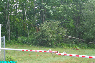
Below are a few damage pictures I was able to get along HWY 53.
Below is the Reflectivity loop using level 2 data as it shows the finer details.You will have to click on the radar to get the loop to play...
Below is the Radial Velocity loop, once again using level 2 data…. Level 3 data is good for out in the field won’t eat up bandwidth as level does learned that the hard way.


