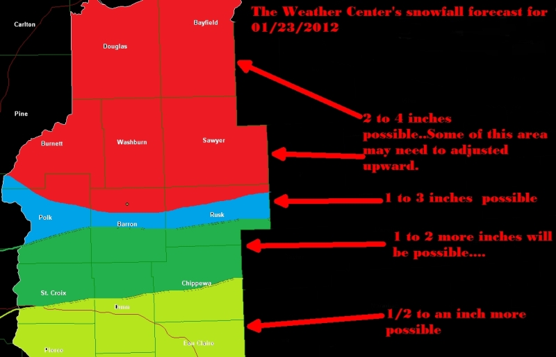
Area of low pressure is forecasted to become stronger as it heads into Northeastern WI....This will keep the snow going for a few more hours across much of the FA...However it should start to end out in my Western areas....The map below is an overall view....There may be some changes to this, as noted on the Map..One thing not noted on the map is..My Western areas may have to be dropped down in snowfall amounts for today.....