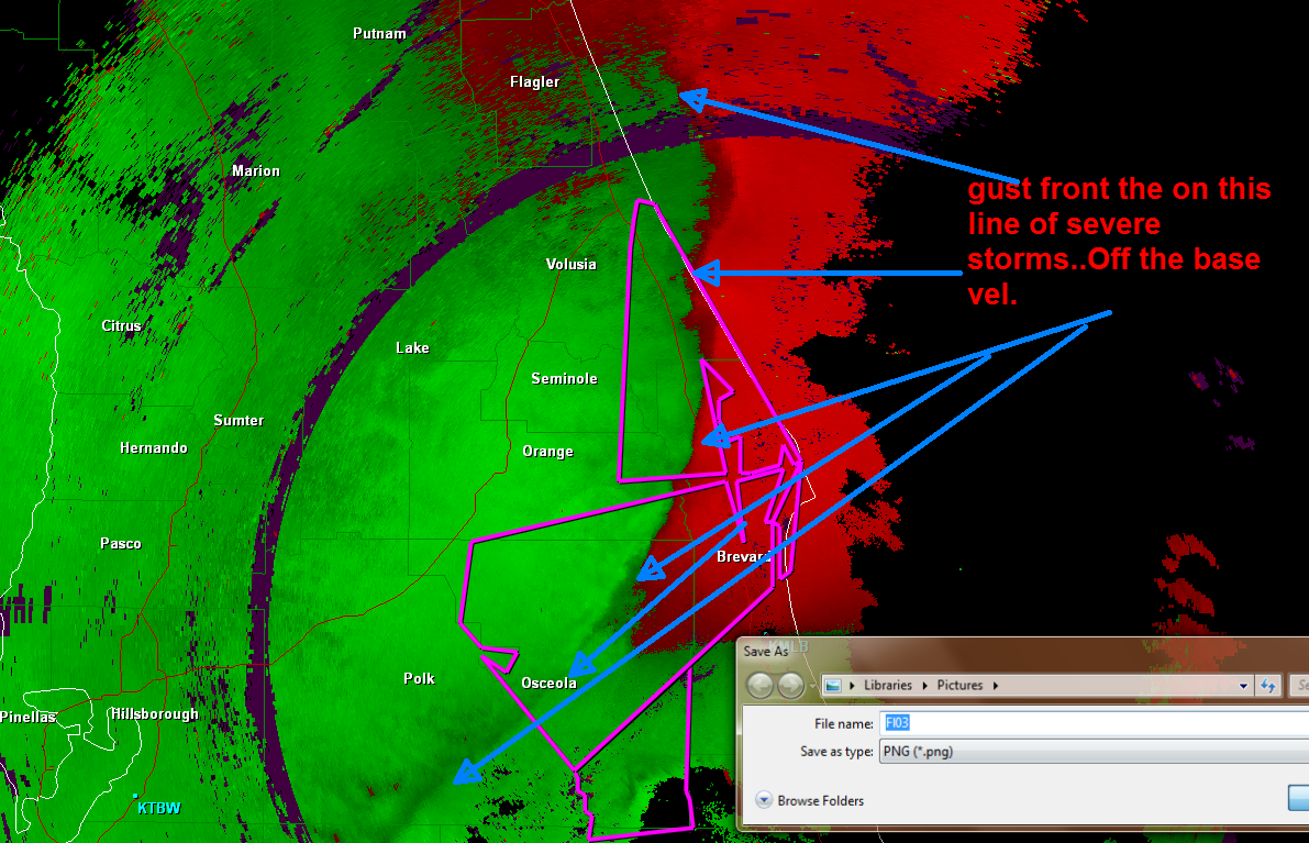
Florida gets rocked by severe thunderstorms tonight…. Along with reported tornadoes.. So I did some radar grabs from different views we use at The Weather Center…. On the radar grabs we did mark with arrows where the squall line is….
What is really interesting on the Spectrum Width image along with the Base vol. and Storm Rel…One can clearly see the Shear Axis. Change of winds along the squall line… Click on images for bigger size… You may also see some areas of rotation… This will be discussed at another time…First image is like the one everyone sees on TV or the internet.. Base Reelfectivity...
Image below is from the Base Velocity....
Image below is from the Storm Reletive.
Last one is off the Spectrum Width... Most people don't see this image, but it is a rather good tool to use.. (had to use fron as I didn't have enough room for all the words.)